Auburn night lights from space
Night Light of Auburn (Washington) from space (United States) Src. Average luminocity for 10x10km area is 76.3943% and for 50x50km: 40.8078%.
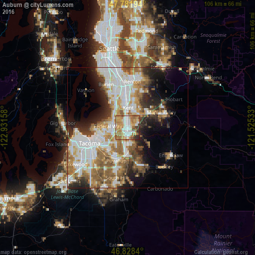
Analysis of Auburn night lights 2016
Square area 10x10 km:
 17.11%
90-99
18.15%80-89
8.63%70-79
21.88%60-69
18.01%50-59
4.91%40-49
2.53%30-39
5.21%20-29
3.57%10-19
0%0-9
0%Square area 50x50 km:
10.88%90-99
9.22%80-89
3.76%70-79
5.13%60-69
6.64%50-59
6.19%40-49
3.95%30-39
3.91%20-29
5.74%10-19
7.94%0-9
36.65%Clear (daylight) street map image can be seen on geolist.org.
Map coordinates:
47° 46' 55" North, 122° 55' 53.7" West
47° 18' 26.4" North, 122° 13' 42.4" West
46° 49' 42.2" North, 121° 31' 31.2" West
Some cities around Auburn sort by population:
• Kent
8.2 km =5.1 mi,  356°
356°
• Federal Way
6.6 km =4.1 mi,  284°
284°
• Lea Hill
4.1 km =2.5 mi,  59°
59°
• Lakeland North
4.7 km =2.9 mi,  308°
308°
• Lakeland South
5.2 km =3.2 mi,  232°
232°
• Edgewood
8 km =5 mi,  217°
217°
• Milton
9.2 km =5.7 mi, 224°
• Pacific
5 km =3.1 mi,  198°
198°
5785965 (p: 77,006)
Sources (retrieved 2019-11-25):
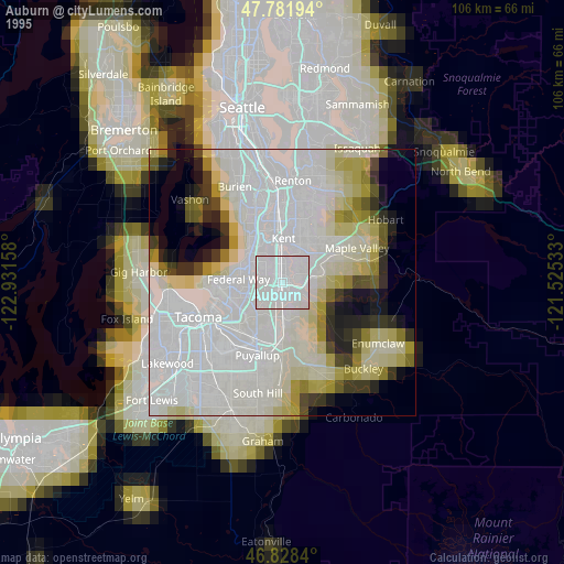
» NASA, Earths city lights 1995
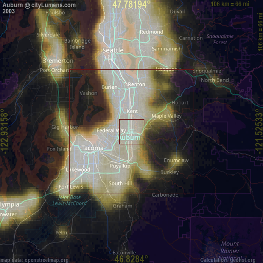
» NASA city lights 2003
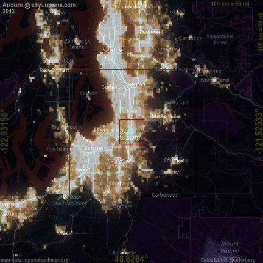
» Earth at Night: Flat Maps 2012, 2016