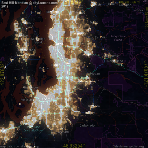
East Hill-Meridian night lights from space
Night Light of East Hill-Meridian (Washington) from space (United States) Src. Average luminocity for 10x10km area is 70.6392% and for 50x50km: 40.8477%.

Analysis of East Hill-Meridian night lights 2016
Square area 10x10 km:
 18.47%
90-99
20.6%80-89
8.1%70-79
8.95%60-69
11.22%50-59
6.25%40-49
3.84%30-39
8.52%20-29
12.64%10-19
1.42%0-9
0%Square area 50x50 km:
12.21%90-99
9.45%80-89
3.5%70-79
4.62%60-69
5.9%50-59
4.86%40-49
4.41%30-39
4.27%20-29
5.6%10-19
7.69%0-9
37.51%Clear (daylight) street map image can be seen on geolist.org.
Map coordinates:
47° 53' 3.1" North, 122° 52' 36.6" West
47° 24' 37.9" North, 122° 10' 25.3" West
46° 55' 57.1" North, 121° 28' 14.1" West
Some cities around East Hill-Meridian sort by population:
• Kent
5.7 km =3.5 mi,  234°
234°
• Renton
8.7 km =5.4 mi,  337°
337°
• SeaTac
9.9 km =6.2 mi,  295°
295°
• Maple Valley
9.8 km =6.1 mi,  101°
101°
• Tukwila
9.6 km =6 mi,  317°
317°
• Covington
7 km =4.3 mi,  146°
146°
• Fairwood
4.4 km =2.7 mi,  16°
16°
• Lea Hill
9.4 km =5.8 mi,  183°
183°
7261759 (p: 29,878)
Sources (retrieved 2019-11-25):
» Earth at Night: Flat Maps 2012, 2016