Independence night lights from space
Night Light of Independence (Missouri) from space (United States) Src. Average luminocity for 10x10km area is 77.6477% and for 50x50km: 55.3537%.
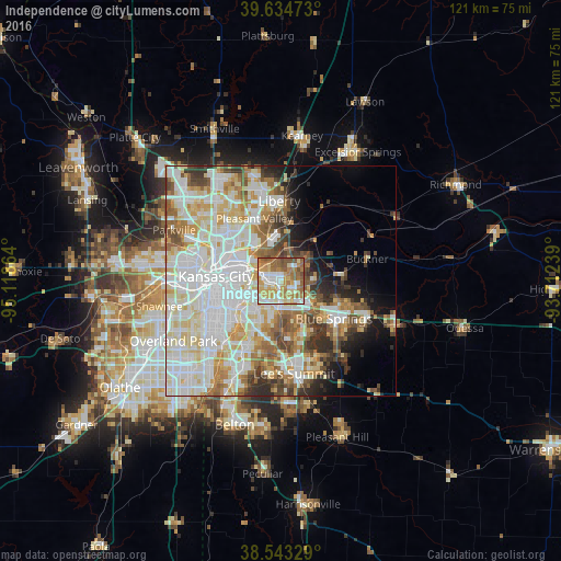
Analysis of Independence night lights 2016
Square area 10x10 km:
 15.75%
90-99
16.56%80-89
14.45%70-79
14.94%60-69
18.67%50-59
13.31%40-49
6.33%30-39
0%20-29
0%10-19
0%0-9
0%Square area 50x50 km:
17.06%90-99
15.19%80-89
7.84%70-79
5.67%60-69
6.34%50-59
5.58%40-49
4.21%30-39
4.5%20-29
3.74%10-19
5.42%0-9
24.44%Clear (daylight) street map image can be seen on geolist.org.
Map coordinates:
39° 38' 5" North, 95° 7' 7.1" West
39° 5' 28" North, 94° 24' 55.8" West
38° 32' 35.8" North, 93° 42' 44.6" West
Some cities around Independence sort by population:
• Kansas City
14.1 km =8.8 mi,  273°
273°
• Kansas City
18.5 km =11.5 mi,  277°
277°
• East Independence
5.2 km =3.2 mi,  84°
84°
• Blue Springs
14.2 km =8.8 mi,  125°
125°
• Liberty
17.2 km =10.7 mi,  358°
358°
• Raytown
10.1 km =6.3 mi,  204°
204°
• Gladstone
17.4 km =10.8 mi,  316°
316°
• Roeland Park
19.6 km =12.2 mi,  252°
252°
4391812 (p: 117,255)
Sources (retrieved 2019-11-25):
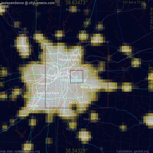
» NASA, Earths city lights 1995
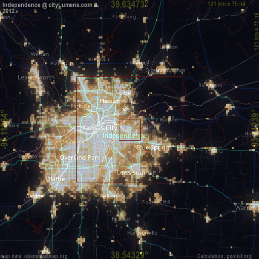
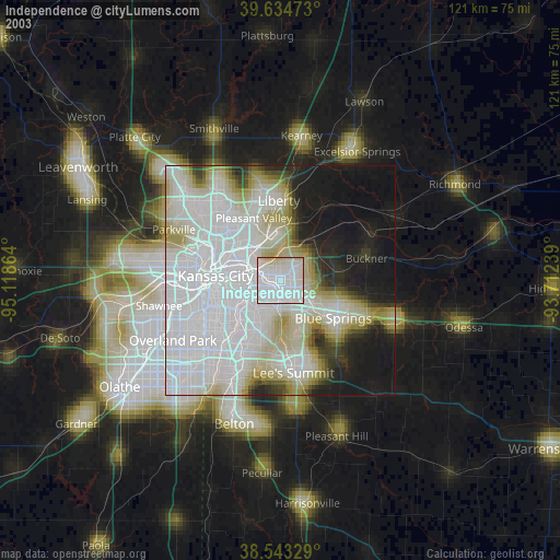
» NASA city lights 2003
» Earth at Night: Flat Maps 2012, 2016