Gladstone night lights from space
Night Light of Gladstone (Missouri) from space (United States) Src. Average luminocity for 10x10km area is 91.5747% and for 50x50km: 51.3735%.
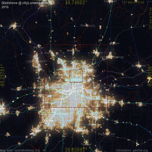
Analysis of Gladstone night lights 2016
Square area 10x10 km:
 28.41%
90-99
34.58%80-89
23.21%70-79
11.85%60-69
1.95%50-59
0%40-49
0%30-39
0%20-29
0%10-19
0%0-9
0%Square area 50x50 km:
14.94%90-99
12.61%80-89
7.29%70-79
5.73%60-69
6.2%50-59
6.06%40-49
4.5%30-39
4.21%20-29
4.16%10-19
8.53%0-9
25.77%Clear (daylight) street map image can be seen on geolist.org.
Map coordinates:
39° 44' 47.9" North, 95° 15' 28.1" West
39° 12' 14" North, 94° 33' 16.8" West
38° 39' 24.9" North, 93° 51' 5.6" West
Some cities around Gladstone sort by population:
• Kansas City
11.8 km =7.3 mi,  190°
190°
• Kansas City
11.8 km =7.3 mi,  212°
212°
• Independence
17.4 km =10.8 mi,  136°
136°
• East Independence
21 km =13 mi,  125°
125°
• Liberty
12.6 km =7.8 mi,  68°
68°
• Smithville
20.5 km =12.7 mi,  353°
353°
• Roeland Park
19.7 km =12.2 mi,  199°
199°
• Parkville
11 km =6.8 mi,  264°
264°
4387990 (p: 26,861)
Sources (retrieved 2019-11-25):
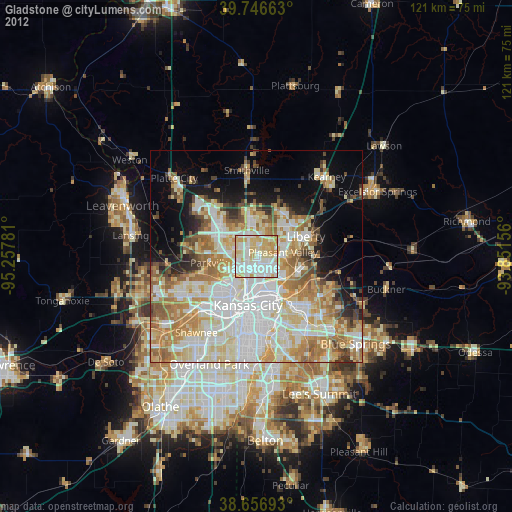
» Earth at Night: Flat Maps 2012, 2016