East Independence night lights from space
Night Light of East Independence (Missouri) from space (United States) Src. Average luminocity for 10x10km area is 54.7305% and for 50x50km: 46.5983%.
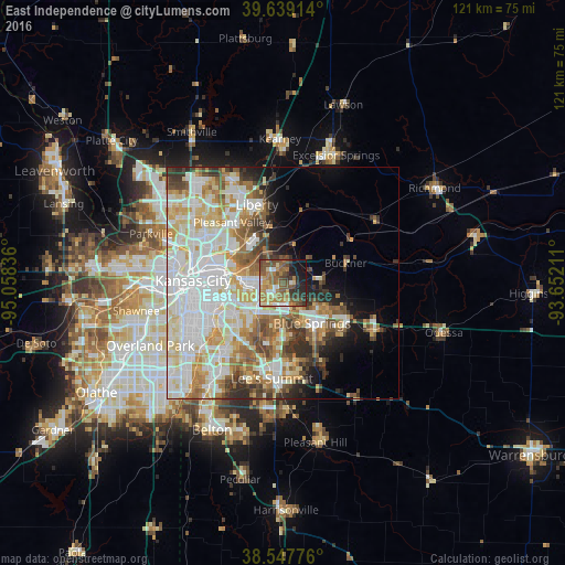
Analysis of East Independence night lights 2016
Square area 10x10 km:
 5.19%
5.19%90-99
6.82%80-89
7.79%70-79
7.47%60-69
16.88%50-59
12.82%40-49
14.12%30-39
7.47%20-29
9.09%10-19
10.23%0-9
2.11%Square area 50x50 km:
13.88%90-99
11.92%80-89
6.31%70-79
5.19%60-69
5.73%50-59
4.96%40-49
3.93%30-39
4.49%20-29
3.86%10-19
5.55%0-9
34.19%Clear (daylight) street map image can be seen on geolist.org.
Map coordinates:
39° 38' 20.9" North, 95° 3' 30.1" West
39° 5' 44" North, 94° 21' 18.8" West
38° 32' 51.9" North, 93° 39' 7.6" West
Some cities around East Independence sort by population:
• Kansas City
19.3 km =12 mi,  271°
271°
• Independence
5.2 km =3.2 mi,  264°
264°
• Lee's Summit
20.7 km =12.9 mi,  186°
186°
• Blue Springs
10.8 km =6.7 mi,  143°
143°
• Liberty
17.6 km =10.9 mi,  341°
341°
• Raytown
13.5 km =8.4 mi,  224°
224°
• Gladstone
21 km =13 mi,  305°
305°
• Grain Valley
16.2 km =10.1 mi,  123°
123°
4385018 (p: 110,675)
Sources (retrieved 2019-11-25):
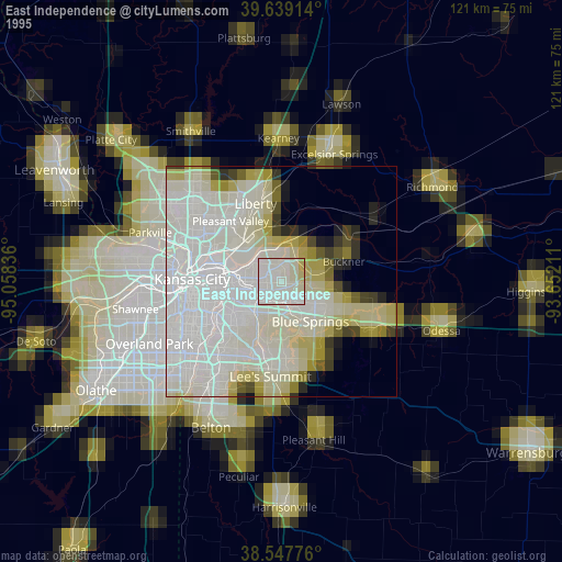
» NASA, Earths city lights 1995
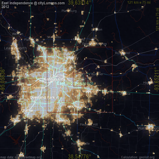
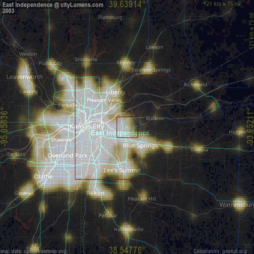
» NASA city lights 2003
» Earth at Night: Flat Maps 2012, 2016