Ham Lake night lights from space
Night Light of Ham Lake (Minnesota) from space (United States) Src. Average luminocity for 10x10km area is 27.1818% and for 50x50km: 29.9783%.
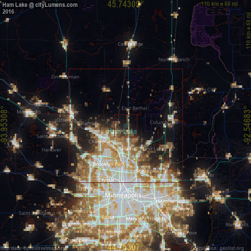
Analysis of Ham Lake night lights 2016
Square area 10x10 km:
 0.91%
0.91%90-99
0.61%80-89
3.33%70-79
2.27%60-69
2.58%50-59
5.15%40-49
15.91%30-39
8.64%20-29
9.24%10-19
21.82%0-9
29.55%Square area 50x50 km:
6.04%90-99
6.02%80-89
3.48%70-79
3.88%60-69
5.38%50-59
4.3%40-49
4.2%30-39
3.25%20-29
5.34%10-19
9.84%0-9
48.25%Clear (daylight) street map image can be seen on geolist.org.
Map coordinates:
45° 44' 35.1" North, 93° 57' 11.1" West
45° 15' 0.9" North, 93° 14' 59.8" West
44° 45' 11.1" North, 92° 32' 48.6" West
Some cities around Ham Lake sort by population:
• West Coon Rapids
12.7 km =7.9 mi,  217°
217°
• Coon Rapids
14.8 km =9.2 mi,  191°
191°
• Blaine
10 km =6.2 mi,  173°
173°
• Andover
3.7 km =2.3 mi,  239°
239°
• Champlin
13.4 km =8.3 mi, 239°
• Anoka
12.2 km =7.6 mi, 241°
• East Bethel
8.5 km =5.3 mi,  25°
25°
• Oak Grove
11.7 km =7.3 mi,  329°
329°
5029181 (p: 16,062)
Sources (retrieved 2019-11-25):
» Earth at Night: Flat Maps 2012, 2016