Greenlawn night lights from space
Night Light of Greenlawn (New York) from space (United States) Src. Average luminocity for 10x10km area is 69.4796% and for 50x50km: 50.3696%.
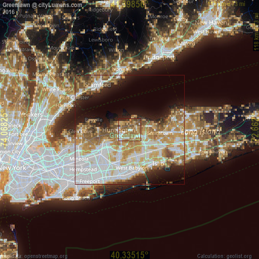
Analysis of Greenlawn night lights 2016
Square area 10x10 km:
 8.67%
8.67%90-99
10.71%80-89
9.86%70-79
17.18%60-69
22.62%50-59
19.9%40-49
6.12%30-39
1.19%20-29
3.74%10-19
0%0-9
0%Square area 50x50 km:
14.12%90-99
11.66%80-89
6.31%70-79
8.18%60-69
7.21%50-59
6.42%40-49
3.51%30-39
2.34%20-29
5.1%10-19
8.75%0-9
26.42%Clear (daylight) street map image can be seen on geolist.org.
Map coordinates:
41° 23' 54.8" North, 74° 4' 5.7" West
40° 52' 8.4" North, 73° 21' 54.4" West
40° 20' 6.5" North, 72° 39' 43.2" West
Some cities around Greenlawn sort by population:
• Commack
6.7 km =4.2 mi,  115°
115°
• Huntington Station
4.3 km =2.7 mi,  246°
246°
• East Northport
3.5 km =2.2 mi,  75°
75°
• Huntington
5.1 km =3.2 mi,  268°
268°
• Elwood
3.6 km =2.2 mi,  136°
136°
• South Huntington
5.8 km =3.6 mi,  209°
209°
• Northport
4 km =2.5 mi,  27°
27°
• Centerport
2 km =1.2 mi,  332°
332°
5119377 (p: 13,742)
Sources (retrieved 2019-11-25):
» Earth at Night: Flat Maps 2012, 2016