Huntington night lights from space
Night Light of Huntington (New York) from space (United States) Src. Average luminocity for 10x10km area is 63.8724% and for 50x50km: 53.3067%.
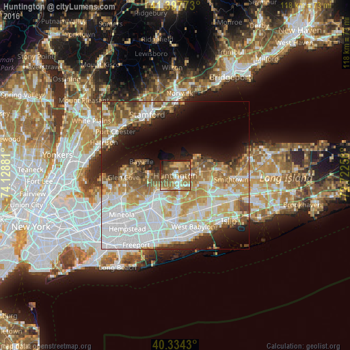
Analysis of Huntington night lights 2016
Square area 10x10 km:
 7.82%
7.82%90-99
8.5%80-89
8.33%70-79
12.24%60-69
18.2%50-59
21.94%40-49
11.9%30-39
3.06%20-29
5.27%10-19
2.72%0-9
0%Square area 50x50 km:
16.61%90-99
12.2%80-89
6.42%70-79
7.61%60-69
7.27%50-59
6.19%40-49
3.78%30-39
2.76%20-29
5.42%10-19
9.08%0-9
22.66%Clear (daylight) street map image can be seen on geolist.org.
Map coordinates:
41° 23' 51.8" North, 74° 7' 43.7" West
40° 52' 5.3" North, 73° 25' 32.4" West
40° 20' 3.5" North, 72° 43' 21.2" West
Some cities around Huntington sort by population:
• Syosset
7.9 km =4.9 mi,  234°
234°
• Greenlawn
5.1 km =3.2 mi,  88°
88°
• South Huntington
5.4 km =3.4 mi,  155°
155°
• Woodbury
5.9 km =3.7 mi,  216°
216°
• Northport
7.8 km =4.8 mi,  62°
62°
• West Hills
5.8 km =3.6 mi,  185°
185°
• Centerport
4.6 km =2.9 mi,  65°
65°
• Cold Spring Harbor
2.6 km =1.6 mi,  278°
278°
5121636 (p: 18,046)
Sources (retrieved 2019-11-25):
» Earth at Night: Flat Maps 2012, 2016