Gramercy Park night lights from space
Night Light of Gramercy Park (New York) from space (United States) Src. Average luminocity for 10x10km area is 99.0276% and for 50x50km: 82.8254%.
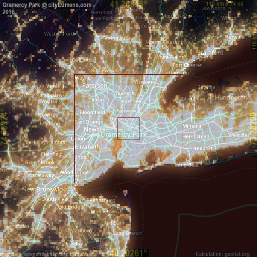
Analysis of Gramercy Park night lights 2016
Square area 10x10 km:
 86.85%
90-99
9.42%80-89
1.46%70-79
2.11%60-69
0.16%50-59
0%40-49
0%30-39
0%20-29
0%10-19
0%0-9
0%Square area 50x50 km:
47.91%90-99
20.36%80-89
5.72%70-79
5.39%60-69
3.45%50-59
1.72%40-49
1.81%30-39
2.06%20-29
3.48%10-19
3.59%0-9
4.51%Clear (daylight) street map image can be seen on geolist.org.
Map coordinates:
41° 16' 5.3" North, 74° 41' 21.3" West
40° 44' 15" North, 73° 59' 10" West
40° 12' 9.4" North, 73° 16' 58.8" West
Some cities around Gramercy Park sort by population:
• New York City
3.1 km =1.9 mi,  212°
212°
• East Village
0.9 km =0.6 mi,  186°
186°
• Financial District
3.8 km =2.4 mi, 209°
• Hoboken
4 km =2.5 mi,  280°
280°
• Hell's Kitchen
3.1 km =1.9 mi,  352°
352°
• Greenpoint
3.3 km =2.1 mi,  117°
117°
• Williamsburg
3.8 km =2.4 mi,  133°
133°
• Long Island City
3.3 km =2.1 mi,  75°
75°
7184841 (p: 27,988)
Sources (retrieved 2019-11-25):
» Earth at Night: Flat Maps 2012, 2016