Gonzales night lights from space
Night Light of Gonzales (Texas) from space (United States) Src. Average luminocity for 10x10km area is 21.3011% and for 50x50km: 3.7578%.
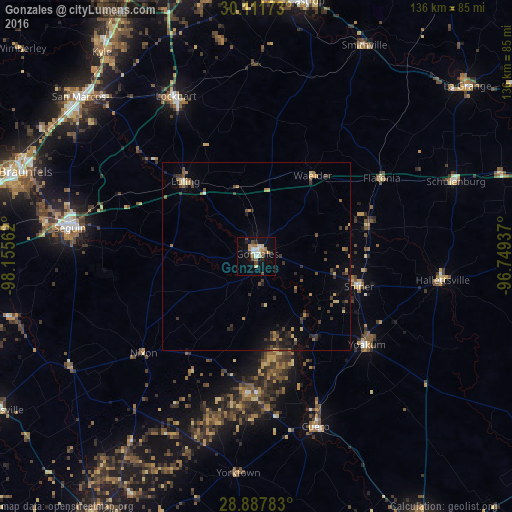
Analysis of Gonzales night lights 2016
Square area 10x10 km:
 2.84%
2.84%90-99
3.22%80-89
2.27%70-79
3.03%60-69
4.17%50-59
1.89%40-49
3.22%30-39
1.33%20-29
2.84%10-19
13.07%0-9
62.12%Square area 50x50 km:
0.15%90-99
0.18%80-89
0.46%70-79
0.49%60-69
0.65%50-59
0.5%40-49
0.64%30-39
1.13%20-29
1.08%10-19
1.61%0-9
93.1%Clear (daylight) street map image can be seen on geolist.org.
Map coordinates:
30° 6' 42.2" North, 98° 9' 20.2" West
29° 30' 5.9" North, 97° 27' 9" West
28° 53' 16.2" North, 96° 44' 57.7" West
Some cities around Gonzales sort by population:
• New Braunfels
68.7 km =42.7 mi,  289°
289°
• San Marcos
63.5 km =39.5 mi,  311°
311°
• Kyle
68 km =42.3 mi,  322°
322°
• Seguin
50.1 km =31.1 mi,  278°
278°
• Lockhart
47.5 km =29.5 mi,  333°
333°
• Cuero
48 km =29.8 mi,  160°
160°
• Yoakum
37.6 km =23.4 mi,  129°
129°
• Luling
27.4 km =17 mi, 316°
4693940 (p: 7,544)
Sources (retrieved 2019-11-25):
» Earth at Night: Flat Maps 2012, 2016