Cuero night lights from space
Night Light of Cuero (Texas) from space (United States) Src. Average luminocity for 10x10km area is 20.2798% and for 50x50km: 7.9324%.
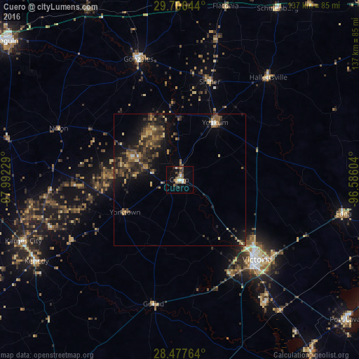
Analysis of Cuero night lights 2016
Square area 10x10 km:
 2.38%
2.38%90-99
2.38%80-89
0.4%70-79
3.17%60-69
4.17%50-59
4.17%40-49
3.77%30-39
2.98%20-29
1.98%10-19
10.91%0-9
63.69%Square area 50x50 km:
0.2%90-99
0.23%80-89
0.99%70-79
0.94%60-69
1.38%50-59
1.7%40-49
1.83%30-39
2.48%20-29
3.2%10-19
5.89%0-9
81.17%Clear (daylight) street map image can be seen on geolist.org.
Map coordinates:
29° 42' 23.2" North, 97° 59' 32.2" West
29° 5' 37.9" North, 97° 17' 21" West
28° 28' 39.5" North, 96° 35' 9.7" West
Some cities around Cuero sort by population:
• Victoria
42.4 km =26.3 mi,  139°
139°
• Seguin
84.1 km =52.3 mi,  308°
308°
• Port Lavaca
83.7 km =52 mi,  129°
129°
• Gonzales
48 km =29.8 mi,  340°
340°
• Floresville
84.3 km =52.4 mi,  273°
273°
• Yoakum
25.3 km =15.7 mi,  31°
31°
• Edna
63.8 km =39.6 mi,  101°
101°
• Luling
73.9 km =45.9 mi,  331°
331°
4684547 (p: 7,115)
Sources (retrieved 2019-11-25):
» Earth at Night: Flat Maps 2012, 2016