New Braunfels night lights from space
Night Light of New Braunfels (Texas) from space (United States) Src. Average luminocity for 10x10km area is 68.8155% and for 50x50km: 24.1473%.
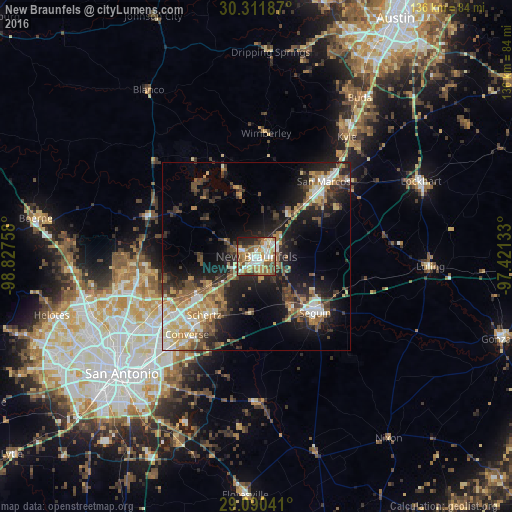

Analysis of New Braunfels night lights 2016
Square area 10x10 km:
 12.5%
12.5%90-99
15.28%80-89
7.34%70-79
14.48%60-69
14.29%50-59
13.89%40-49
9.52%30-39
2.98%20-29
7.54%10-19
2.18%0-9
0%Square area 50x50 km:
2.9%90-99
3.5%80-89
2.79%70-79
3.35%60-69
3.71%50-59
4.18%40-49
4.41%30-39
4.29%20-29
7.19%10-19
13.79%0-9
49.91%Clear (daylight) street map image can be seen on geolist.org.
Map coordinates:
30° 18' 42.7" North, 98° 49' 39.3" West
29° 42' 10.8" North, 98° 7' 28" West
29° 5' 25.5" North, 97° 25' 16.8" West
Some cities around New Braunfels sort by population:
• San Marcos
26.7 km =16.6 mi,  41°
41°
• Schertz
21.9 km =13.6 mi,  219°
219°
• Seguin
21.5 km =13.4 mi,  134°
134°
• Cibolo
18.6 km =11.6 mi,  212°
212°
• Canyon Lake
23.3 km =14.5 mi,  325°
325°
• Universal City
23.6 km =14.7 mi, 223°
• Live Oak
25.6 km =15.9 mi,  233°
233°
• Selma
21.9 km =13.6 mi, 233°
4714131 (p: 70,543)
Sources (retrieved 2019-11-25):
» NASA, Earths city lights 1995
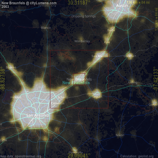
» NASA city lights 2003
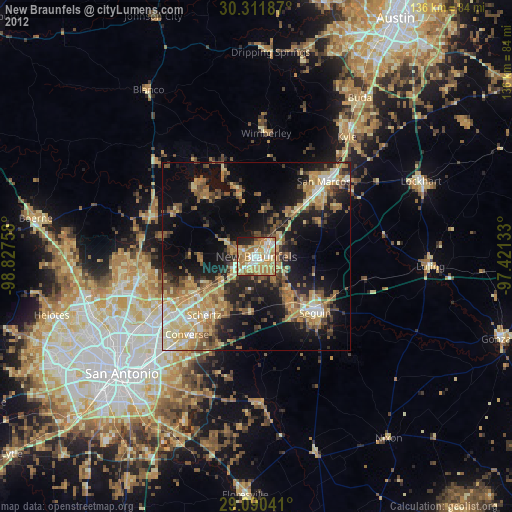
» Earth at Night: Flat Maps 2012, 2016