San Marcos night lights from space
Night Light of San Marcos (Texas) from space (United States) Src. Average luminocity for 10x10km area is 56.3571% and for 50x50km: 15.3032%.
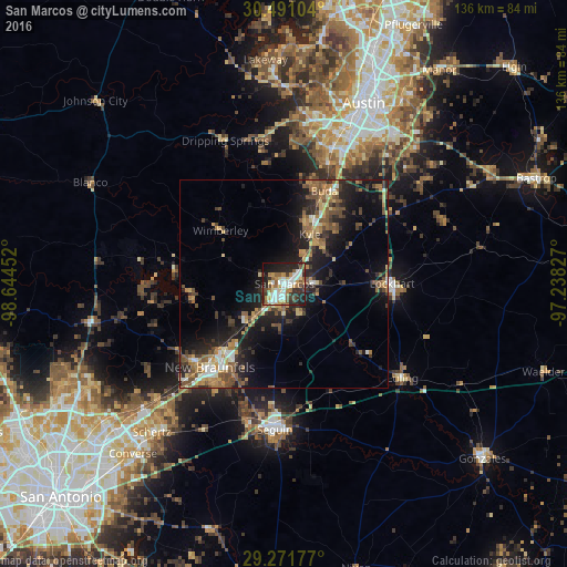
Analysis of San Marcos night lights 2016
Square area 10x10 km:
 12.9%
12.9%90-99
12.7%80-89
4.96%70-79
6.94%60-69
9.92%50-59
6.15%40-49
5.75%30-39
8.13%20-29
20.24%10-19
11.71%0-9
0.6%Square area 50x50 km:
1.39%90-99
1.55%80-89
1.43%70-79
2.07%60-69
2.78%50-59
3.17%40-49
3.11%30-39
2.48%20-29
5.47%10-19
11.15%0-9
65.4%Clear (daylight) street map image can be seen on geolist.org.
Map coordinates:
30° 29' 27.7" North, 98° 38' 40.3" West
29° 52' 59.8" North, 97° 56' 29" West
29° 16' 18.4" North, 97° 14' 17.8" West
Some cities around San Marcos sort by population:
• New Braunfels
26.7 km =16.6 mi,  221°
221°
• Kyle
13.3 km =8.3 mi,  27°
27°
• Seguin
35 km =21.7 mi,  183°
183°
• Canyon Lake
31 km =19.3 mi,  268°
268°
• Buda
24.5 km =15.2 mi,  23°
23°
• Lockhart
26.2 km =16.3 mi,  89°
89°
• Luling
36.2 km =22.5 mi,  128°
128°
• Shady Hollow
32.2 km =20 mi,  13°
13°
4726491 (p: 60,684)
Sources (retrieved 2019-11-25):
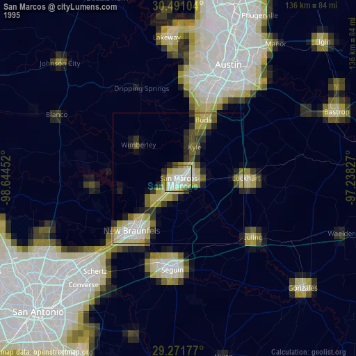
» NASA, Earths city lights 1995
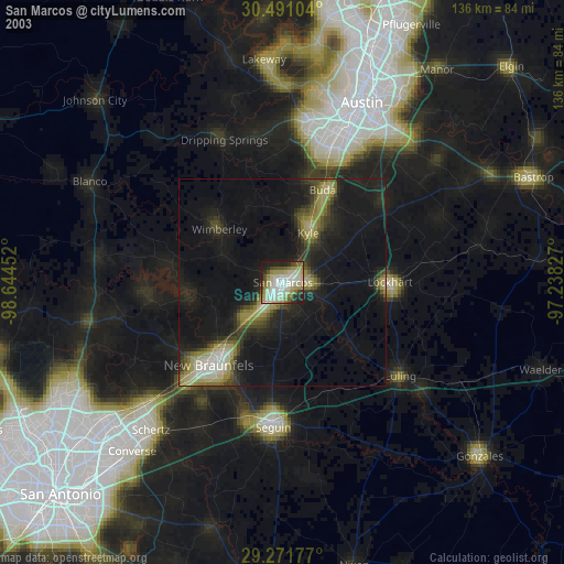
» NASA city lights 2003
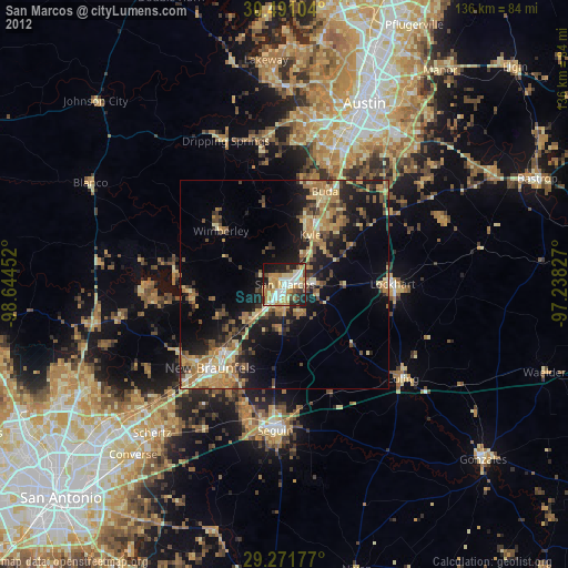
» Earth at Night: Flat Maps 2012, 2016