Kyle night lights from space
Night Light of Kyle (Texas) from space (United States) Src. Average luminocity for 10x10km area is 42.5985% and for 50x50km: 20.5125%.
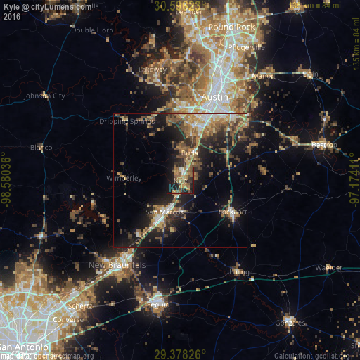
Analysis of Kyle night lights 2016
Square area 10x10 km:
 2.84%
2.84%90-99
3.41%80-89
3.22%70-79
9.85%60-69
11.93%50-59
13.45%40-49
5.68%30-39
4.36%20-29
12.31%10-19
26.7%0-9
6.25%Square area 50x50 km:
1.91%90-99
2.06%80-89
2.61%70-79
2.79%60-69
3.64%50-59
4.32%40-49
4.08%30-39
3.64%20-29
6.47%10-19
13.55%0-9
54.93%Clear (daylight) street map image can be seen on geolist.org.
Map coordinates:
30° 35' 46.4" North, 98° 34' 49.3" West
29° 59' 20.8" North, 97° 52' 38" West
29° 22' 41.7" North, 97° 10' 26.8" West
Some cities around Kyle sort by population:
• Austin
33.5 km =20.8 mi,  22°
22°
• New Braunfels
39.8 km =24.7 mi,  216°
216°
• San Marcos
13.3 km =8.3 mi,  207°
207°
• Canyon Lake
39.2 km =24.4 mi,  251°
251°
• Buda
11.3 km =7 mi, 18°
• Lockhart
23.1 km =14.4 mi,  120°
120°
• Bee Cave
36.1 km =22.4 mi,  349°
349°
• Shady Hollow
19.6 km =12.2 mi,  4°
4°
4703811 (p: 35,733)
Sources (retrieved 2019-11-25):
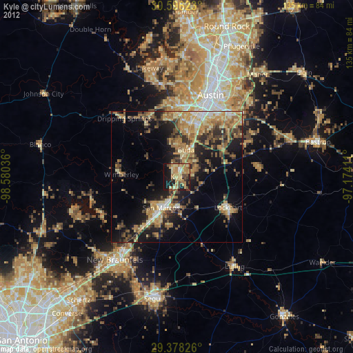
» Earth at Night: Flat Maps 2012, 2016