Fort Riley North night lights from space
Night Light of Fort Riley North (Kansas) from space (United States) Src. Average luminocity for 10x10km area is 35.0049% and for 50x50km: 6.991%.
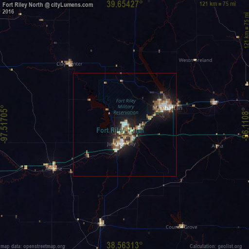
Analysis of Fort Riley North night lights 2016
Square area 10x10 km:
 4.06%
4.06%90-99
5.68%80-89
7.14%70-79
3.9%60-69
2.76%50-59
3.73%40-49
6.49%30-39
5.68%20-29
11.53%10-19
27.76%0-9
21.27%Square area 50x50 km:
0.87%90-99
0.85%80-89
1.01%70-79
0.76%60-69
0.88%50-59
1.13%40-49
1.06%30-39
0.99%20-29
1.77%10-19
6.3%0-9
84.37%Clear (daylight) street map image can be seen on geolist.org.
Map coordinates:
39° 39' 15.4" North, 97° 31' 1.4" West
39° 6' 38.9" North, 96° 48' 50.1" West
38° 33' 47.3" North, 96° 6' 38.9" West
Some cities around Fort Riley North sort by population:
• Topeka
98.3 km =61.1 mi,  94°
94°
• Manhattan
22.4 km =13.9 mi,  68°
68°
• Salina
75.2 km =46.7 mi,  246°
246°
• Emporia
95.8 km =59.5 mi,  145°
145°
• Junction City
9.3 km =5.8 mi,  189°
189°
• McPherson
110.5 km =68.7 mi,  221°
221°
• Abilene
40.7 km =25.3 mi,  238°
238°
• Concordia
89.1 km =55.4 mi,  305°
305°
7259267 (p: 7,761)
Sources (retrieved 2019-11-25):
» Earth at Night: Flat Maps 2012, 2016