Topeka night lights from space
Night Light of Topeka (Kansas) from space (United States) Src. Average luminocity for 10x10km area is 82.5422% and for 50x50km: 10.1509%.

Analysis of Topeka night lights 2016
Square area 10x10 km:
 23.05%
90-99
25.16%80-89
15.1%70-79
11.04%60-69
10.88%50-59
9.58%40-49
2.76%30-39
0.97%20-29
1.46%10-19
0%0-9
0%Square area 50x50 km:
1.47%90-99
1.69%80-89
1.45%70-79
1.23%60-69
1.25%50-59
1.68%40-49
1.96%30-39
2.02%20-29
2.11%10-19
4.38%0-9
80.74%Clear (daylight) street map image can be seen on geolist.org.
Map coordinates:
39° 35' 32.2" North, 96° 22' 52.2" West
39° 2' 54" North, 95° 40' 40.9" West
38° 30' 0.6" North, 94° 58' 29.7" West
Some cities around Topeka sort by population:
• Lawrence
39.2 km =24.4 mi,  102°
102°
• Gardner
70.1 km =43.6 mi,  112°
112°
• Ottawa
59.8 km =37.2 mi,  143°
143°
• Bonner Springs
68.6 km =42.6 mi,  88°
88°
• Eudora
51.4 km =31.9 mi, 103°
• De Soto
61.8 km =38.4 mi, 97°
• Basehor
64.6 km =40.1 mi,  80°
80°
• Tonganoxie
51.4 km =31.9 mi, 82°
4280539 (p: 127,265)
Sources (retrieved 2019-11-25):
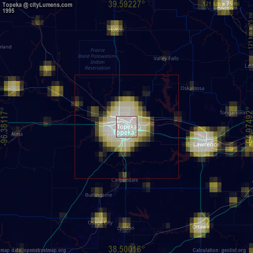
» NASA, Earths city lights 1995
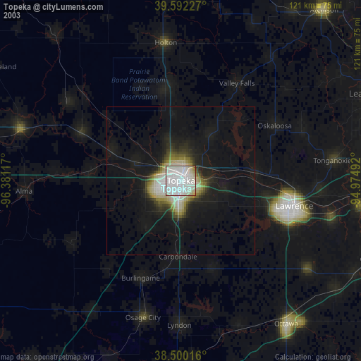
» NASA city lights 2003
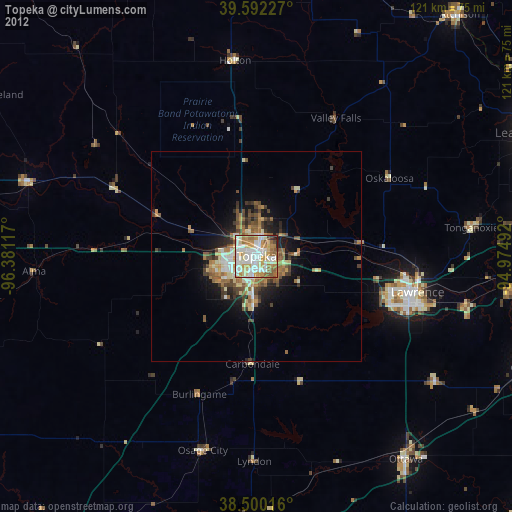
» Earth at Night: Flat Maps 2012, 2016