Eustis night lights from space
Night Light of Eustis (Florida) from space (United States) Src. Average luminocity for 10x10km area is 59.0587% and for 50x50km: 25.8536%.
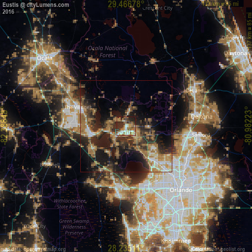
Analysis of Eustis night lights 2016
Square area 10x10 km:
 8.71%
8.71%90-99
12.12%80-89
5.68%70-79
7.58%60-69
19.7%50-59
8.33%40-49
6.44%30-39
9.09%20-29
18.37%10-19
3.98%0-9
0%Square area 50x50 km:
2.1%90-99
3.01%80-89
2.07%70-79
2.37%60-69
9.62%50-59
3.55%40-49
3.81%30-39
6.71%20-29
9.01%10-19
15.01%0-9
42.75%Clear (daylight) street map image can be seen on geolist.org.
Map coordinates:
29° 28' 0.4" North, 82° 23' 18.5" West
28° 51' 10" North, 81° 41' 7.3" West
28° 14' 6.4" North, 80° 58' 56" West
Some cities around Eustis sort by population:
• The Villages
28.2 km =17.5 mi,  288°
288°
• Apopka
25.9 km =16.1 mi,  139°
139°
• Wekiwa Springs
30.6 km =19 mi,  124°
124°
• Leesburg
19.3 km =12 mi,  256°
256°
• Tavares
6.7 km =4.2 mi,  215°
215°
• Lady Lake
24.2 km =15 mi, 287°
• Mount Dora
6.9 km =4.3 mi, 144°
• South Apopka
27.3 km =17 mi, 141°
4154606 (p: 19,986)
Sources (retrieved 2019-11-25):
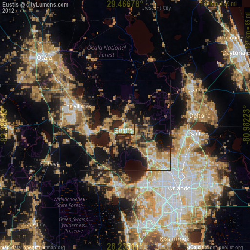
» Earth at Night: Flat Maps 2012, 2016