Wekiwa Springs night lights from space
Night Light of Wekiwa Springs (Florida) from space (United States) Src. Average luminocity for 10x10km area is 73.1042% and for 50x50km: 61.4969%.
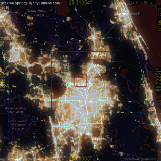
Analysis of Wekiwa Springs night lights 2016
Square area 10x10 km:
 14.96%
90-99
21.78%80-89
11.55%70-79
15.15%60-69
12.31%50-59
1.89%40-49
3.79%30-39
7.95%20-29
10.61%10-19
0%0-9
0%Square area 50x50 km:
17%90-99
17.17%80-89
7.35%70-79
7.93%60-69
10.4%50-59
4.18%40-49
3.7%30-39
5.44%20-29
6.88%10-19
7.71%0-9
12.24%Clear (daylight) street map image can be seen on geolist.org.
Map coordinates:
29° 18' 48.7" North, 82° 7' 43.5" West
28° 41' 55" North, 81° 25' 32.3" West
28° 4' 48.2" North, 80° 43' 21" West
Some cities around Wekiwa Springs sort by population:
• Apopka
8.8 km =5.5 mi,  253°
253°
• Altamonte Springs
7.2 km =4.5 mi,  125°
125°
• Longwood
8.5 km =5.3 mi,  86°
86°
• Forest City
3.9 km =2.4 mi,  206°
206°
• Lockhart
9 km =5.6 mi,  190°
190°
• Fern Park
9.1 km =5.7 mi, 127°
• Heathrow
8.9 km =5.5 mi,  35°
35°
• South Apopka
9.1 km =5.7 mi,  243°
243°
4177671 (p: 21,998)
Sources (retrieved 2019-11-25):
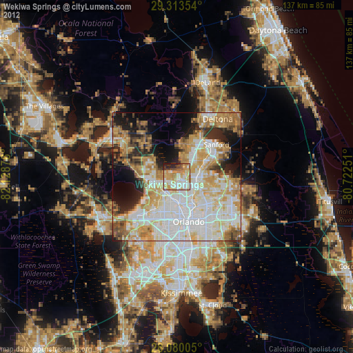
» Earth at Night: Flat Maps 2012, 2016