Renton night lights from space
Night Light of Renton (Washington) from space (United States) Src. Average luminocity for 10x10km area is 88.8565% and for 50x50km: 41.2635%.
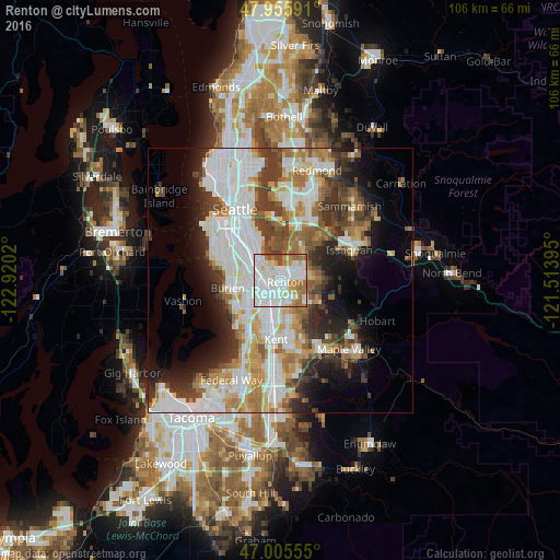
Analysis of Renton night lights 2016
Square area 10x10 km:
 40.48%
90-99
25.57%80-89
7.81%70-79
7.39%60-69
13.21%50-59
2.27%40-49
3.27%30-39
0%20-29
0%10-19
0%0-9
0%Square area 50x50 km:
12.19%90-99
9.68%80-89
3.69%70-79
4.75%60-69
5.57%50-59
4.18%40-49
4.43%30-39
5.35%20-29
6.16%10-19
8.26%0-9
35.73%Clear (daylight) street map image can be seen on geolist.org.
Map coordinates:
47° 57' 21.3" North, 122° 55' 12.7" West
47° 28' 58.4" North, 122° 13' 1.5" West
47° 0' 20" North, 121° 30' 50.2" West
Some cities around Renton sort by population:
• SeaTac
6.8 km =4.2 mi,  235°
235°
• Tukwila
3.4 km =2.1 mi,  253°
253°
• Fairwood
5.9 km =3.7 mi,  130°
130°
• Bryn Mawr-Skyway
2.2 km =1.4 mi,  305°
305°
• Newcastle
7.8 km =4.8 mi,  36°
36°
• East Renton Highlands
7.9 km =4.9 mi,  88°
88°
• Riverton
5.8 km =3.6 mi,  271°
271°
• Boulevard Park
7.4 km =4.6 mi,  275°
275°
5808189 (p: 100,242)
Sources (retrieved 2019-11-25):
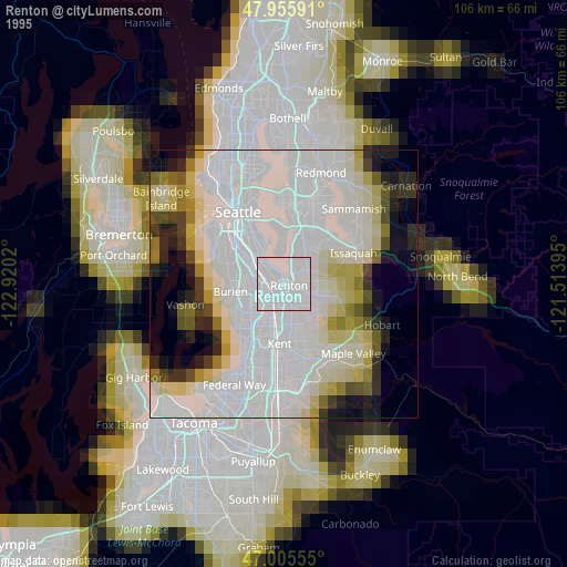
» NASA, Earths city lights 1995
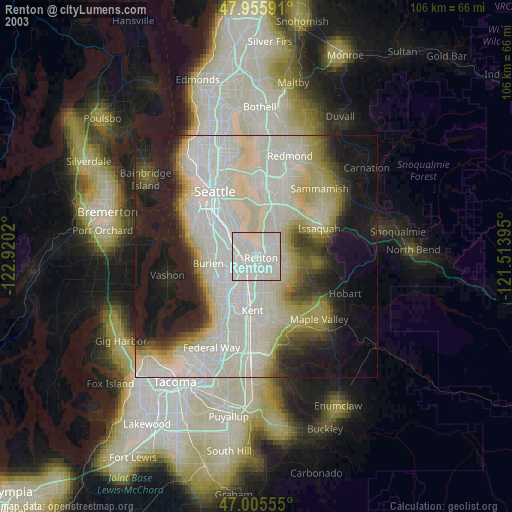
» NASA city lights 2003
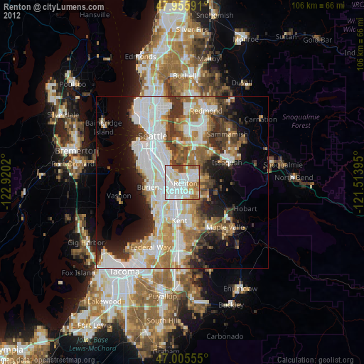
» Earth at Night: Flat Maps 2012, 2016