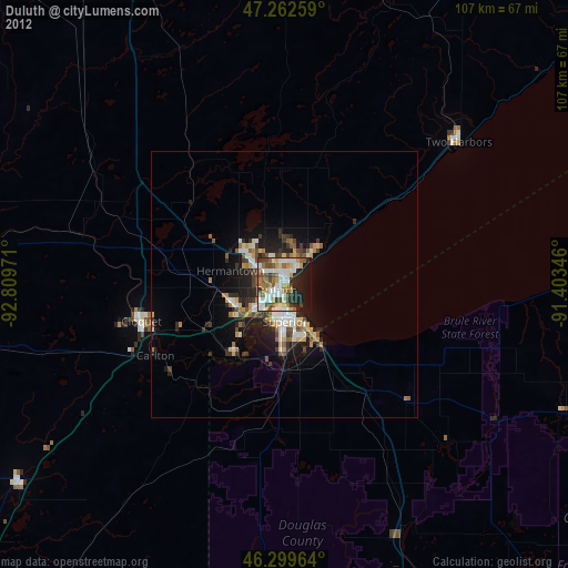
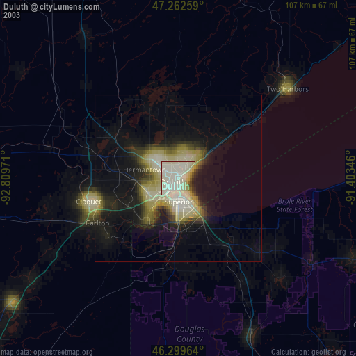
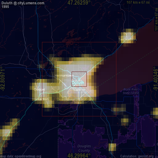
Duluth night lights from space
Night Light of Duluth (Minnesota) from space (United States) Src. Average luminocity for 10x10km area is 58.2991% and for 50x50km: 7.5447%.

Analysis of Duluth night lights 2016
Square area 10x10 km:
 13.84%
90-99
16.22%80-89
2.98%70-79
3.72%60-69
8.18%50-59
7.89%40-49
11.61%30-39
13.1%20-29
11.9%10-19
10.57%0-9
0%Square area 50x50 km:
1.21%90-99
1.52%80-89
0.56%70-79
0.7%60-69
0.78%50-59
0.98%40-49
1.23%30-39
1.4%20-29
2.73%10-19
4.74%0-9
84.15%Clear (daylight) street map image can be seen on geolist.org.
Map coordinates:
47° 15' 45.3" North, 92° 48' 35" West
46° 46' 59.8" North, 92° 6' 23.7" West
46° 17' 58.7" North, 91° 24' 12.5" West
Some cities around Duluth sort by population:
• Superior
7 km =4.3 mi,  178°
178°
• Hibbing
95.3 km =59.2 mi,  318°
318°
• Cloquet
27.7 km =17.2 mi,  255°
255°
• Grand Rapids
119.1 km =74 mi,  295°
295°
• Hermantown
10.4 km =6.5 mi,  284°
284°
• Virginia
88.5 km =55 mi,  338°
338°
• Rice Lake
144.8 km =90 mi,  168°
168°
• Ashland
95.6 km =59.4 mi,  102°
102°
5024719 (p: 86,110)
Sources (retrieved 2019-11-25):
» NASA, Earths city lights 1995
» NASA city lights 2003
» Earth at Night: Flat Maps 2012, 2016