Deschutes River Woods night lights from space
Night Light of Deschutes River Woods (Oregon) from space (United States) Src. Average luminocity for 10x10km area is 8.8238% and for 50x50km: 2.5953%.
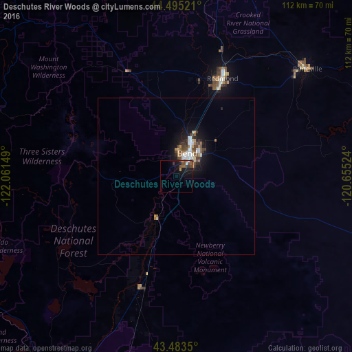
Analysis of Deschutes River Woods night lights 2016
Square area 10x10 km:
 0.48%
0.48%90-99
0.48%80-89
0%70-79
0.95%60-69
0.32%50-59
3.49%40-49
2.54%30-39
1.9%20-29
1.59%10-19
11.59%0-9
76.67%Square area 50x50 km:
0.39%90-99
0.41%80-89
0.15%70-79
0.27%60-69
0.33%50-59
0.37%40-49
0.61%30-39
0.41%20-29
0.45%10-19
2.09%0-9
94.53%Clear (daylight) street map image can be seen on geolist.org.
Map coordinates:
44° 29' 42.8" North, 122° 3' 41.4" West
43° 59' 29.4" North, 121° 21' 30.1" West
43° 29' 0.6" North, 120° 39' 18.9" West
Some cities around Deschutes River Woods sort by population:
• Bend
8.2 km =5.1 mi,  24°
24°
• Springfield
133.2 km =82.8 mi,  272°
272°
• Redmond
34.5 km =21.4 mi,  25°
25°
• Lebanon
137.4 km =85.4 mi,  296°
296°
• Prineville
54.1 km =33.6 mi,  50°
50°
• Sweet Home
118.8 km =73.8 mi,  292°
292°
• Madras
73.7 km =45.8 mi,  14°
14°
• Creswell
133.6 km =83 mi, 266°
5722960 (p: 5,077)
Sources (retrieved 2019-11-25):
» Earth at Night: Flat Maps 2012, 2016