Sweet Home night lights from space
Night Light of Sweet Home (Oregon) from space (United States) Src. Average luminocity for 10x10km area is 6.9317% and for 50x50km: 1.1355%.
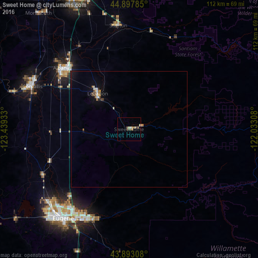
Analysis of Sweet Home night lights 2016
Square area 10x10 km:
 0.32%
0.32%90-99
1.43%80-89
1.43%70-79
0%60-69
1.9%50-59
0.79%40-49
2.06%30-39
0.32%20-29
0%10-19
0%0-9
91.75%Square area 50x50 km:
0.12%90-99
0.19%80-89
0.09%70-79
0.12%60-69
0.2%50-59
0.09%40-49
0.25%30-39
0.08%20-29
0.05%10-19
0.55%0-9
98.25%Clear (daylight) street map image can be seen on geolist.org.
Map coordinates:
44° 53' 52.3" North, 123° 26' 21.6" West
44° 23' 51.4" North, 122° 44' 10.3" West
43° 53' 35.1" North, 122° 1' 59.1" West
Some cities around Sweet Home sort by population:
• Eugene
47.5 km =29.5 mi,  216°
216°
• Springfield
45.2 km =28.1 mi,  210°
210°
• Corvallis
45.7 km =28.4 mi,  293°
293°
• Albany
39.6 km =24.6 mi,  312°
312°
• Lebanon
20.5 km =12.7 mi,  318°
318°
• Stayton
45.1 km =28 mi,  354°
354°
• Junction City
42.3 km =26.3 mi,  242°
242°
• Creswell
58.1 km =36.1 mi,  203°
203°
5755674 (p: 9,270)
Sources (retrieved 2019-11-25):
» Earth at Night: Flat Maps 2012, 2016