Madras night lights from space
Night Light of Madras (Oregon) from space (United States) Src. Average luminocity for 10x10km area is 10.0985% and for 50x50km: 0.6471%.
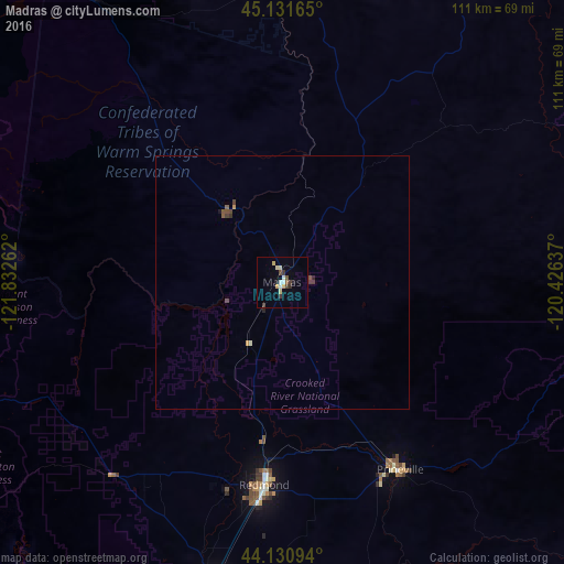
Analysis of Madras night lights 2016
Square area 10x10 km:
 0.91%
0.91%90-99
1.97%80-89
1.97%70-79
1.21%60-69
0%50-59
1.06%40-49
1.82%30-39
2.42%20-29
0.15%10-19
1.21%0-9
87.27%Square area 50x50 km:
0.04%90-99
0.1%80-89
0.08%70-79
0.1%60-69
0%50-59
0.14%40-49
0.18%30-39
0.18%20-29
0.05%10-19
0.07%0-9
99.05%Clear (daylight) street map image can be seen on geolist.org.
Map coordinates:
45° 7' 53.9" North, 121° 49' 57.4" West
44° 38' 0.4" North, 121° 7' 46.2" West
44° 7' 51.4" North, 120° 25' 34.9" West
Some cities around Madras sort by population:
• Bend
65.6 km =40.8 mi,  193°
193°
• Redmond
40.3 km =25 mi, 185°
• The Dalles
106.9 km =66.4 mi,  357°
357°
• Sandy
123 km =76.4 mi,  313°
313°
• Prineville
43.9 km =27.3 mi,  147°
147°
• Molalla
127.5 km =79.2 mi,  296°
296°
• Hood River
123.1 km =76.5 mi,  345°
345°
• Deschutes River Woods
73.7 km =45.8 mi, 194°
5738690 (p: 6,662)
Sources (retrieved 2019-11-25):
» Earth at Night: Flat Maps 2012, 2016