Coshocton night lights from space
Night Light of Coshocton (Ohio) from space (United States) Src. Average luminocity for 10x10km area is 24.4935% and for 50x50km: 2.6835%.
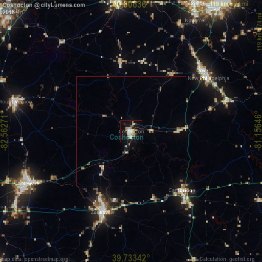
Analysis of Coshocton night lights 2016
Square area 10x10 km:
 2.92%
2.92%90-99
4.22%80-89
4.22%70-79
1.95%60-69
4.71%50-59
1.79%40-49
2.27%30-39
1.46%20-29
3.25%10-19
28.08%0-9
45.13%Square area 50x50 km:
0.18%90-99
0.38%80-89
0.46%70-79
0.4%60-69
0.31%50-59
0.28%40-49
0.28%30-39
0.2%20-29
0.4%10-19
1.72%0-9
95.38%Clear (daylight) street map image can be seen on geolist.org.
Map coordinates:
40° 48' 22.9" North, 82° 33' 45.8" West
40° 16' 19.3" North, 81° 51' 34.5" West
39° 44' 0.3" North, 81° 9' 23.3" West
Some cities around Coshocton sort by population:
• Newark
51.8 km =32.2 mi,  242°
242°
• Zanesville
39.1 km =24.3 mi,  199°
199°
• New Philadelphia
42.6 km =26.5 mi,  55°
55°
• Mount Vernon
54.8 km =34.1 mi,  284°
284°
• Dover
42.8 km =26.6 mi,  49°
49°
• Cambridge
35.3 km =21.9 mi,  139°
139°
• Uhrichsville
45.5 km =28.3 mi,  72°
72°
• Apple Valley
45.8 km =28.5 mi,  293°
293°
5151186 (p: 11,121)
Sources (retrieved 2019-11-25):
» Earth at Night: Flat Maps 2012, 2016