Citrus night lights from space
Night Light of Citrus (California) from space (United States) Src. Average luminocity for 10x10km area is 87.4414% and for 50x50km: 54.1796%.
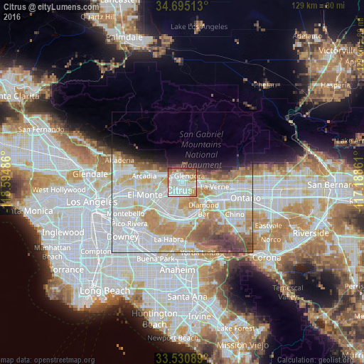
Analysis of Citrus night lights 2016
Square area 10x10 km:
 32.23%
90-99
30.04%80-89
6.41%70-79
13.19%60-69
7.33%50-59
8.06%40-49
2.75%30-39
0%20-29
0%10-19
0%0-9
0%Square area 50x50 km:
17.76%90-99
16.3%80-89
5.66%70-79
7.86%60-69
6.59%50-59
3.97%40-49
3.43%30-39
1.98%20-29
2%10-19
3.96%0-9
30.48%Clear (daylight) street map image can be seen on geolist.org.
Map coordinates:
34° 41' 42.5" North, 118° 35' 41.5" West
34° 6' 54" North, 117° 53' 30.2" West
33° 31' 51.2" North, 117° 11' 19" West
Some cities around Citrus sort by population:
• West Covina
6.7 km =4.2 mi,  220°
220°
• Baldwin Park
7.2 km =4.5 mi,  242°
242°
• Glendora
3.4 km =2.1 mi,  45°
45°
• Azusa
2.5 km =1.6 mi,  324°
324°
• Covina
2.8 km =1.7 mi,  177°
177°
• San Dimas
7.9 km =4.9 mi,  96°
96°
• Vincent
3.5 km =2.2 mi, 237°
• Charter Oak
4.4 km =2.7 mi,  107°
107°
5337551 (p: 10,866)
Sources (retrieved 2019-11-25):
» Earth at Night: Flat Maps 2012, 2016