San Dimas night lights from space
Night Light of San Dimas (California) from space (United States) Src. Average luminocity for 10x10km area is 78.5714% and for 50x50km: 53.6192%.
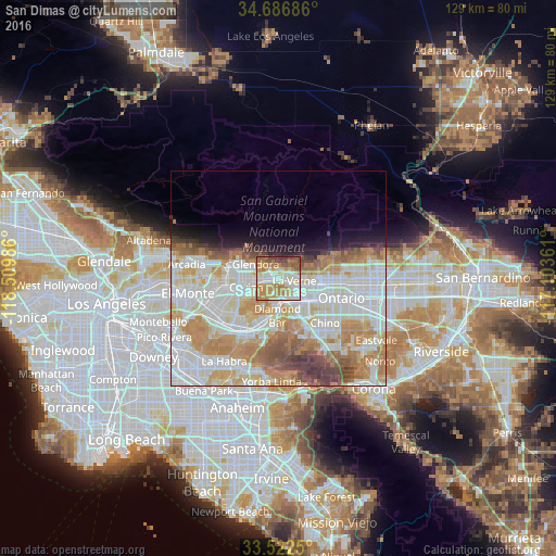
Analysis of San Dimas night lights 2016
Square area 10x10 km:
 17.03%
90-99
18.32%80-89
10.81%70-79
22.16%60-69
16.85%50-59
8.24%40-49
5.13%30-39
1.47%20-29
0%10-19
0%0-9
0%Square area 50x50 km:
16.52%90-99
14.69%80-89
5.77%70-79
8.99%60-69
8.37%50-59
4.25%40-49
3.48%30-39
2.06%20-29
1.96%10-19
3.93%0-9
29.99%Clear (daylight) street map image can be seen on geolist.org.
Map coordinates:
34° 41' 12.7" North, 118° 30' 35.5" West
34° 6' 24" North, 117° 48' 24.2" West
33° 31' 21" North, 117° 6' 13" West
Some cities around San Dimas sort by population:
• Pomona
7.6 km =4.7 mi,  138°
138°
• Diamond Bar
8.7 km =5.4 mi,  182°
182°
• Glendora
6.3 km =3.9 mi,  301°
301°
• Covina
7.9 km =4.9 mi,  256°
256°
• Claremont
8.1 km =5 mi,  97°
97°
• La Verne
3.6 km =2.2 mi, 100°
• Citrus
7.9 km =4.9 mi,  276°
276°
• Charter Oak
3.6 km =2.2 mi, 263°
5391891 (p: 34,630)
Sources (retrieved 2019-11-25):
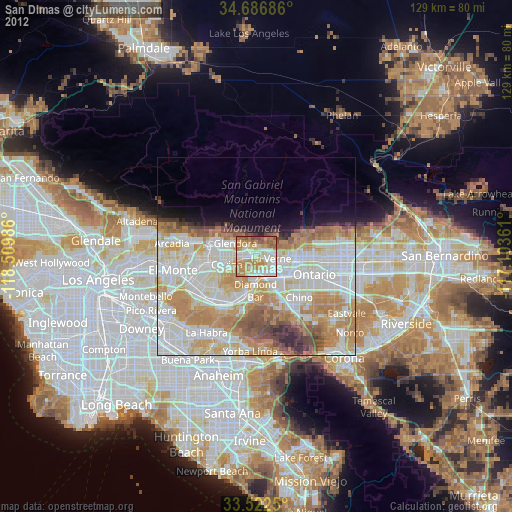
» Earth at Night: Flat Maps 2012, 2016