Vincent night lights from space
Night Light of Vincent (California) from space (United States) Src. Average luminocity for 10x10km area is 95.2564% and for 50x50km: 58.4856%.
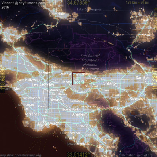
Analysis of Vincent night lights 2016
Square area 10x10 km:
 40.11%
90-99
41.94%80-89
8.97%70-79
7.69%60-69
1.28%50-59
0%40-49
0%30-39
0%20-29
0%10-19
0%0-9
0%Square area 50x50 km:
21.04%90-99
16.65%80-89
6.28%70-79
8.1%60-69
6.68%50-59
3.81%40-49
3.41%30-39
2.08%20-29
1.98%10-19
4%0-9
25.97%Clear (daylight) street map image can be seen on geolist.org.
Map coordinates:
34° 40' 42.9" North, 118° 37' 37.1" West
34° 5' 54.1" North, 117° 55' 25.8" West
33° 30' 50.8" North, 117° 13' 14.6" West
Some cities around Vincent sort by population:
• West Covina
3.6 km =2.2 mi,  202°
202°
• Baldwin Park
3.7 km =2.3 mi,  246°
246°
• Azusa
4.2 km =2.6 mi,  20°
20°
• Covina
3.2 km =2 mi,  106°
106°
• Valinda
6.2 km =3.9 mi, 197°
• West Puente Valley
6.6 km =4.1 mi,  218°
218°
• Duarte
6.7 km =4.2 mi,  312°
312°
• Citrus
3.5 km =2.2 mi,  57°
57°
7262464 (p: 15,922)
Sources (retrieved 2019-11-25):
» Earth at Night: Flat Maps 2012, 2016