Azusa night lights from space
Night Light of Azusa (California) from space (United States) Src. Average luminocity for 10x10km area is 78.0073% and for 50x50km: 51.8326%.
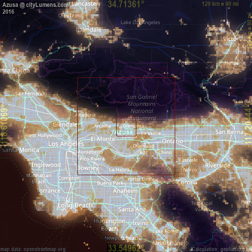
Analysis of Azusa night lights 2016
Square area 10x10 km:
 25.09%
90-99
25.46%80-89
6.78%70-79
9.16%60-69
6.78%50-59
7.51%40-49
7.88%30-39
5.86%20-29
5.49%10-19
0%0-9
0%Square area 50x50 km:
17.33%90-99
15.86%80-89
5.43%70-79
7.23%60-69
6.13%50-59
3.6%40-49
2.93%30-39
1.68%20-29
2.01%10-19
3.99%0-9
33.8%Clear (daylight) street map image can be seen on geolist.org.
Map coordinates:
34° 42' 49" North, 118° 36' 38.5" West
34° 8' 1" North, 117° 54' 27.2" West
33° 32' 58.6" North, 117° 12' 16" West
Some cities around Azusa sort by population:
• West Covina
7.8 km =4.8 mi,  201°
201°
• Baldwin Park
7.3 km =4.5 mi,  222°
222°
• Glendora
3.9 km =2.4 mi,  85°
85°
• Covina
5.1 km =3.2 mi,  161°
161°
• Duarte
6.5 km =4 mi,  275°
275°
• Vincent
4.2 km =2.6 mi, 200°
• Citrus
2.5 km =1.6 mi,  144°
144°
• Charter Oak
6.6 km =4.1 mi,  120°
120°
5325423 (p: 49,690)
Sources (retrieved 2019-11-25):
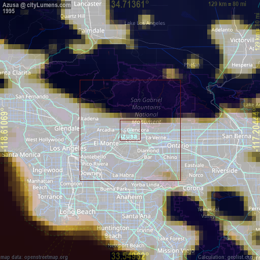
» NASA, Earths city lights 1995
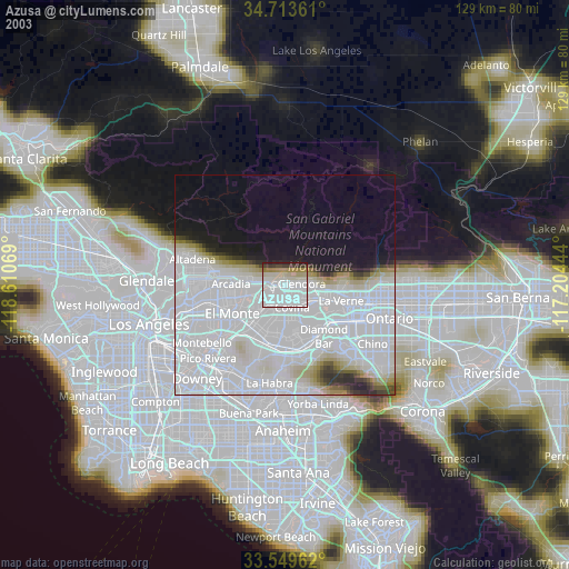
» NASA city lights 2003
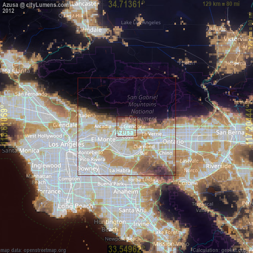
» Earth at Night: Flat Maps 2012, 2016