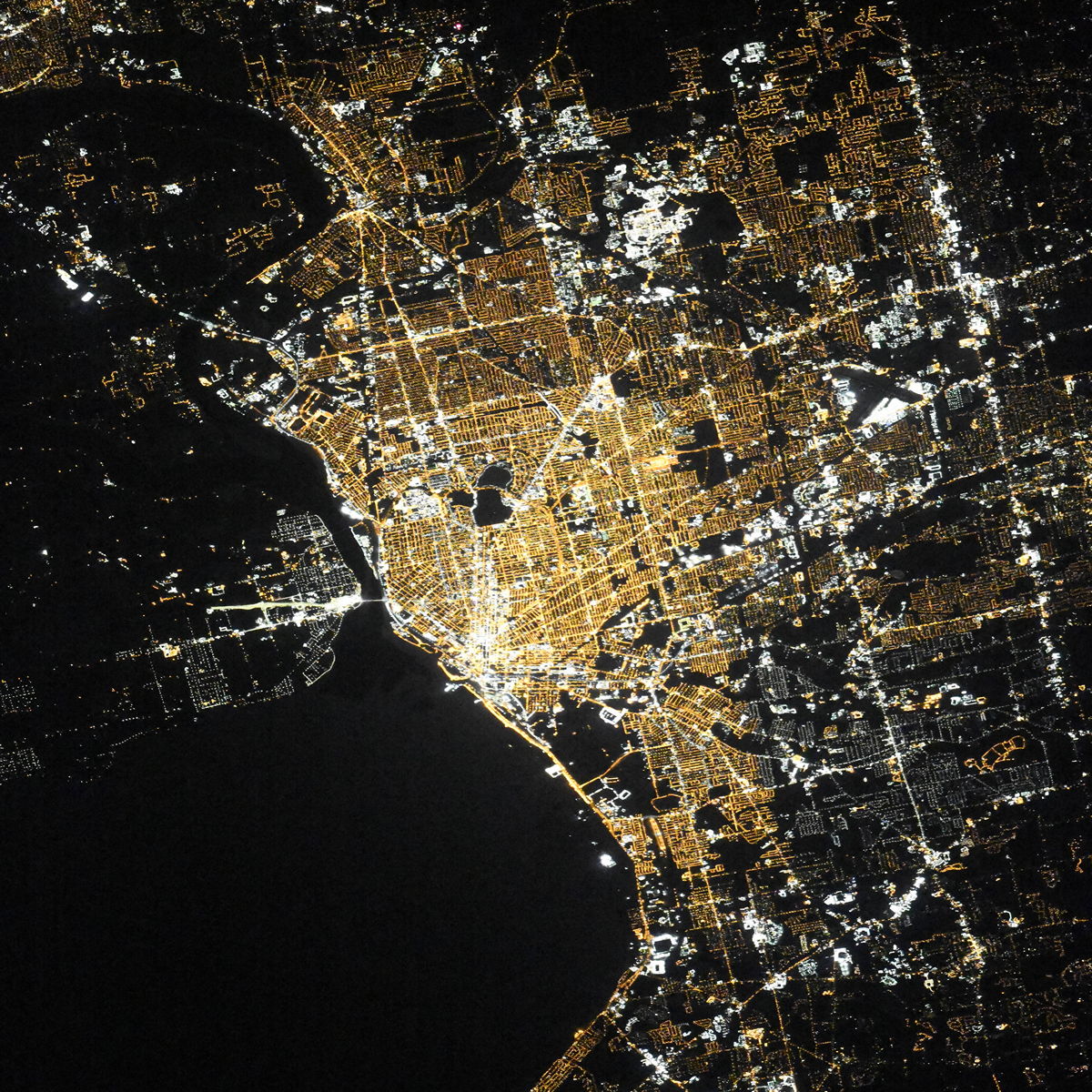
Buffalo night lights from space
Night Light of Buffalo (New York) from space (United States) Src. Average luminocity for 10x10km area is 75.254% and for 50x50km: 35.0133%.
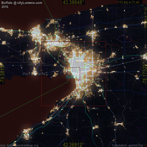
Analysis of Buffalo night lights 2016
Square area 10x10 km:
 46.83%
90-99
12.06%80-89
3.33%70-79
3.65%60-69
3.65%50-59
2.06%40-49
4.29%30-39
7.78%20-29
8.57%10-19
6.51%0-9
1.27%Square area 50x50 km:
7.6%90-99
6.88%80-89
3.66%70-79
4.52%60-69
5.17%50-59
5.18%40-49
5.5%30-39
5.16%20-29
6.26%10-19
10.92%0-9
39.17%Clear (daylight) street map image can be seen on geolist.org.
Map coordinates:
43° 23' 58.1" North, 79° 34' 53.4" West
42° 53' 11.2" North, 78° 52' 42.1" West
42° 22' 8.8" North, 78° 10' 30.9" West
Fantastic image of Buffalo from space taken by astronauts [src2], but I don't have information about it's orientation, scale or angle. If necessary, it was rotated manually, so North points approximately to upper direction. Click to zoom in:
Some cities around Buffalo sort by population:
• Amherst
12.1 km =7.5 mi,  32°
32°
• Thunder Bay, CA
12.8 km =8 mi,  266°
266°
• Cheektowaga
10.2 km =6.3 mi,  79°
79°
• West Seneca
7.6 km =4.7 mi,  122°
122°
• Lackawanna
8.1 km =5 mi,  146°
146°
• Fort Erie, CA
4.7 km =2.9 mi,  288°
288°
• Kenmore
8.9 km =5.5 mi,  4°
4°
• Eggertsville
10.5 km =6.5 mi,  35°
35°
5110629 (p: 258,071)
Sources (retrieved 2019-11-25):
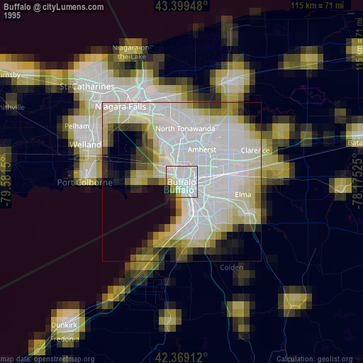
» NASA, Earths city lights 1995
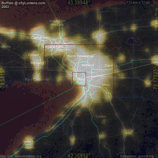
» NASA city lights 2003
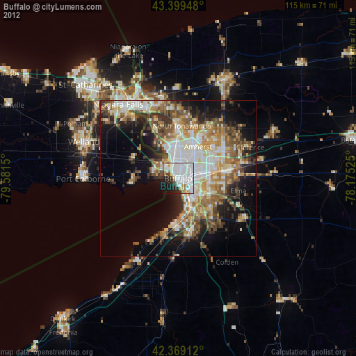
» Earth at Night: Flat Maps 2012, 2016
Src.2: picture by Oleg Kononenko,ĀRoscosmos, retrieved 2019-11-29