Amherst night lights from space
Night Light of Amherst (New York) from space (United States) Src. Average luminocity for 10x10km area is 91.7683% and for 50x50km: 36.5138%.
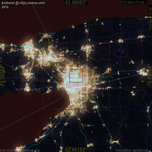
Analysis of Amherst night lights 2016
Square area 10x10 km:
 32.06%
90-99
36.98%80-89
11.59%70-79
15.71%60-69
3.65%50-59
0%40-49
0%30-39
0%20-29
0%10-19
0%0-9
0%Square area 50x50 km:
7.82%90-99
7.26%80-89
3.88%70-79
4.68%60-69
5.23%50-59
5.66%40-49
5.49%30-39
5.27%20-29
6.35%10-19
12.07%0-9
36.28%Clear (daylight) street map image can be seen on geolist.org.
Map coordinates:
43° 29' 26.3" North, 79° 30' 10.4" West
42° 58' 42.2" North, 78° 47' 59.1" West
42° 27' 42.6" North, 78° 5' 47.9" West
Some cities around Amherst sort by population:
• Cheektowaga
9.1 km =5.7 mi,  156°
156°
• North Tonawanda
8.5 km =5.3 mi,  321°
321°
• Kenmore
5.9 km =3.7 mi,  256°
256°
• Depew
12 km =7.5 mi,  133°
133°
• Eggertsville
1.7 km =1.1 mi,  191°
191°
• Tonawanda
8 km =5 mi,  305°
305°
• Harris Hill
10.1 km =6.3 mi,  98°
98°
• Williamsville
5.3 km =3.3 mi,  107°
107°
5107129 (p: 122,366)
Sources (retrieved 2019-11-25):
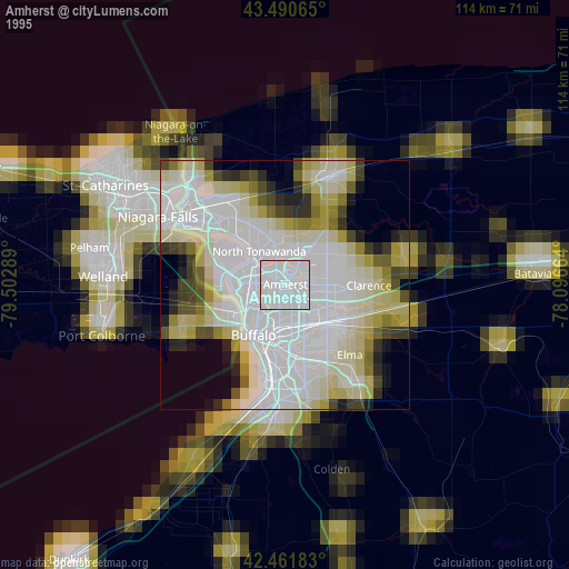
» NASA, Earths city lights 1995
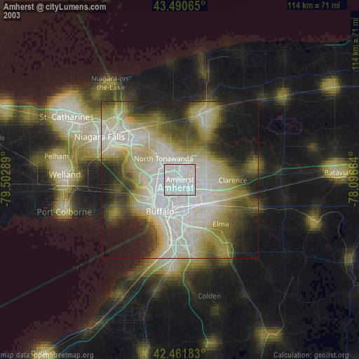
» NASA city lights 2003
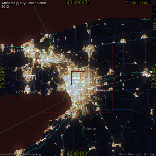
» Earth at Night: Flat Maps 2012, 2016