Fort Erie night lights from space
Night Light of Fort Erie (Ontario) from space (Canada) Src. Average luminocity for 10x10km area is 51.5254% and for 50x50km: 36.5895%.
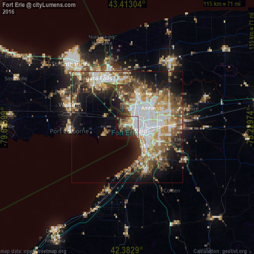
Analysis of Fort Erie night lights 2016
Square area 10x10 km:
 18.57%
90-99
8.1%80-89
3.02%70-79
4.13%60-69
7.14%50-59
4.92%40-49
7.46%30-39
10.48%20-29
10.79%10-19
16.03%0-9
9.37%Square area 50x50 km:
7.87%90-99
7.44%80-89
3.88%70-79
4.75%60-69
5.35%50-59
5.38%40-49
5.75%30-39
5.26%20-29
6.71%10-19
11.3%0-9
36.3%Clear (daylight) street map image can be seen on geolist.org.
Map coordinates:
43° 24' 46.9" North, 79° 38' 9.6" West
42° 54' 0.4" North, 78° 55' 58.3" West
42° 22' 58.4" North, 78° 13' 47.1" West
Some cities around Fort Erie sort by population:
• Buffalo, US
4.7 km =2.9 mi,  108°
108°
• Amherst, US
13.9 km =8.6 mi,  51°
51°
• Thunder Bay
8.6 km =5.3 mi,  255°
255°
• West Seneca, US
12.2 km =7.6 mi,  117°
117°
• Lackawanna, US
12.2 km =7.6 mi,  132°
132°
• Kenmore, US
8.9 km =5.5 mi,  34°
34°
• Eggertsville, US
12.6 km =7.8 mi,  56°
56°
• Tonawanda, US
14 km =8.7 mi,  17°
17°
5955815 (p: 15,953)
Sources (retrieved 2019-11-25):
» Earth at Night: Flat Maps 2012, 2016