Cheektowaga night lights from space
Night Light of Cheektowaga (New York) from space (United States) Src. Average luminocity for 10x10km area is 90.4825% and for 50x50km: 34.283%.
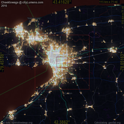
Analysis of Cheektowaga night lights 2016
Square area 10x10 km:
 35.71%
90-99
28.89%80-89
13.02%70-79
12.7%60-69
8.89%50-59
0.79%40-49
0%30-39
0%20-29
0%10-19
0%0-9
0%Square area 50x50 km:
7.34%90-99
6.57%80-89
3.56%70-79
4.34%60-69
5.05%50-59
5.42%40-49
5.64%30-39
4.86%20-29
6.05%10-19
10.96%0-9
40.21%Clear (daylight) street map image can be seen on geolist.org.
Map coordinates:
43° 24' 58.6" North, 79° 27' 28.4" West
42° 54' 12.2" North, 78° 45' 17.1" West
42° 23' 10.3" North, 78° 3' 5.9" West
Some cities around Cheektowaga sort by population:
• Buffalo
10.2 km =6.3 mi,  259°
259°
• Amherst
9.1 km =5.7 mi,  336°
336°
• West Seneca
7 km =4.3 mi,  211°
211°
• Depew
5.1 km =3.2 mi,  89°
89°
• Eggertsville
7.8 km =4.8 mi,  329°
329°
• Lancaster
6.9 km =4.3 mi, 92°
• Harris Hill
9.3 km =5.8 mi,  42°
42°
• Williamsville
6.9 km =4.3 mi,  11°
11°
5112375 (p: 75,178)
Sources (retrieved 2019-11-25):
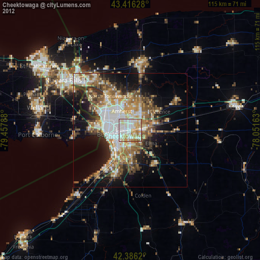
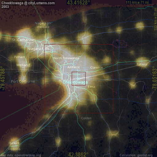
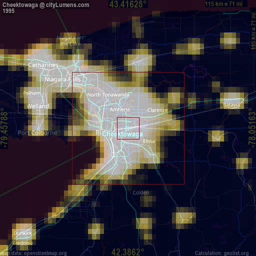
» NASA, Earths city lights 1995
» NASA city lights 2003
» Earth at Night: Flat Maps 2012, 2016