Breckenridge night lights from space
Night Light of Breckenridge (Texas) from space (United States) Src. Average luminocity for 10x10km area is 16.2605% and for 50x50km: 0.808%.
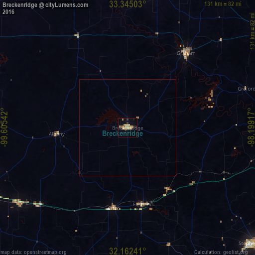
Analysis of Breckenridge night lights 2016
Square area 10x10 km:
 0%
0%90-99
0.17%80-89
6.99%70-79
2.1%60-69
4.02%50-59
1.05%40-49
0.7%30-39
2.97%20-29
0.7%10-19
3.85%0-9
77.45%Square area 50x50 km:
0%90-99
0.01%80-89
0.29%70-79
0.12%60-69
0.2%50-59
0.09%40-49
0.03%30-39
0.13%20-29
0.07%10-19
0.16%0-9
98.91%Clear (daylight) street map image can be seen on geolist.org.
Map coordinates:
33° 20' 42.1" North, 99° 36' 19.5" West
32° 45' 20.4" North, 98° 54' 8.2" West
32° 9' 44.7" North, 98° 11' 57" West
Some cities around Breckenridge sort by population:
• Abilene
85 km =52.8 mi,  246°
246°
• Weatherford
103.3 km =64.2 mi,  89°
89°
• Stephenville
88.6 km =55.1 mi,  132°
132°
• Brownwood
116.6 km =72.5 mi,  184°
184°
• Mineral Wells
74 km =46 mi, 85°
• Granbury
109.5 km =68 mi,  108°
108°
• Graham
48.8 km =30.3 mi,  36°
36°
• Bridgeport
118.4 km =73.6 mi,  64°
64°
4676181 (p: 5,590)
Sources (retrieved 2019-11-25):
» Earth at Night: Flat Maps 2012, 2016