Weatherford night lights from space
Night Light of Weatherford (Texas) from space (United States) Src. Average luminocity for 10x10km area is 46.257% and for 50x50km: 11.6719%.
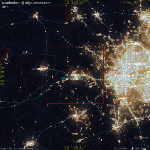
Analysis of Weatherford night lights 2016
Square area 10x10 km:
 5.07%
5.07%90-99
6.47%80-89
5.42%70-79
8.22%60-69
6.99%50-59
11.01%40-49
9.27%30-39
8.39%20-29
12.59%10-19
25.7%0-9
0.87%Square area 50x50 km:
0.35%90-99
0.36%80-89
1.35%70-79
1.58%60-69
1.61%50-59
2.43%40-49
3.15%30-39
3.41%20-29
4.23%10-19
11.86%0-9
69.68%Clear (daylight) street map image can be seen on geolist.org.
Map coordinates:
33° 20' 55" North, 98° 30' 1.4" West
32° 45' 33.5" North, 97° 47' 50.1" West
32° 9' 57.8" North, 97° 5' 38.9" West
Some cities around Weatherford sort by population:
• Benbrook
32.9 km =20.4 mi,  106°
106°
• White Settlement
31.7 km =19.7 mi,  89°
89°
• Mineral Wells
30 km =18.6 mi,  280°
280°
• Azle
27.9 km =17.3 mi,  57°
57°
• Granbury
35.3 km =21.9 mi,  179°
179°
• River Oaks
37.7 km =23.4 mi, 86°
• Eagle Mountain
36.2 km =22.5 mi,  65°
65°
• Briar
35.4 km =22 mi,  42°
42°
4740364 (p: 28,742)
Sources (retrieved 2019-11-25):
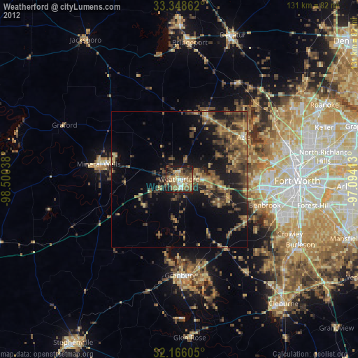
» Earth at Night: Flat Maps 2012, 2016