Brownwood night lights from space
Night Light of Brownwood (Texas) from space (United States) Src. Average luminocity for 10x10km area is 45.3974% and for 50x50km: 2.9384%.
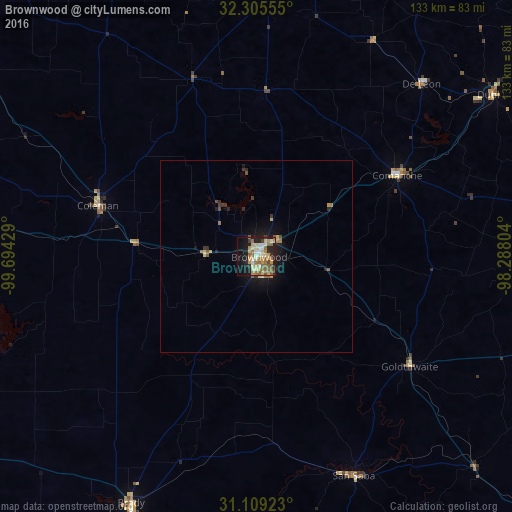
Analysis of Brownwood night lights 2016
Square area 10x10 km:
 3.66%
3.66%90-99
7.69%80-89
9.89%70-79
8.42%60-69
6.78%50-59
12.09%40-49
2.38%30-39
3.66%20-29
8.06%10-19
26.01%0-9
11.36%Square area 50x50 km:
0.15%90-99
0.33%80-89
0.57%70-79
0.42%60-69
0.37%50-59
0.71%40-49
0.23%30-39
0.37%20-29
0.58%10-19
2.58%0-9
93.68%Clear (daylight) street map image can be seen on geolist.org.
Map coordinates:
32° 18' 20" North, 99° 41' 39.4" West
31° 42' 33.6" North, 98° 59' 28.2" West
31° 6' 33.2" North, 98° 17' 16.9" West
Some cities around Brownwood sort by population:
• Abilene
107.9 km =67 mi,  319°
319°
• Copperas Cove
122 km =75.8 mi,  122°
122°
• Stephenville
93.7 km =58.2 mi,  52°
52°
• Gatesville
122 km =75.8 mi,  104°
104°
• Lampasas
105.1 km =65.3 mi,  133°
133°
• Kingsland
128.1 km =79.6 mi,  155°
155°
• Breckenridge
116.6 km =72.5 mi,  4°
4°
• Brady
71.7 km =44.6 mi,  207°
207°
4676798 (p: 19,031)
Sources (retrieved 2019-11-25):
» Earth at Night: Flat Maps 2012, 2016