Stephenville night lights from space
Night Light of Stephenville (Texas) from space (United States) Src. Average luminocity for 10x10km area is 34.451% and for 50x50km: 2.5862%.
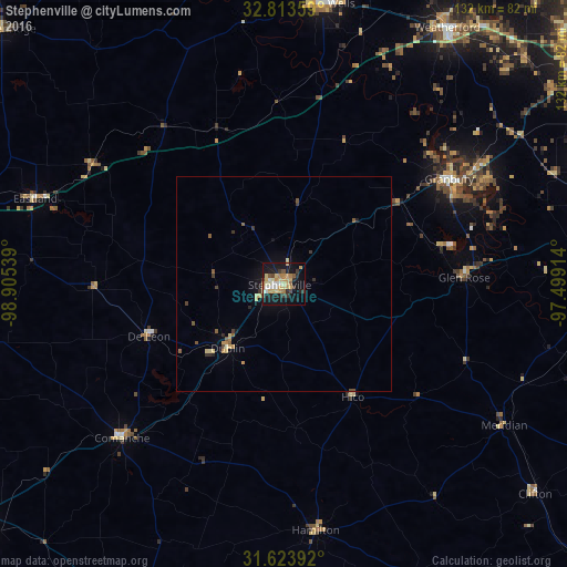
Analysis of Stephenville night lights 2016
Square area 10x10 km:
 3.5%
3.5%90-99
3.32%80-89
7.69%70-79
8.74%60-69
4.72%50-59
2.27%40-49
2.8%30-39
4.9%20-29
3.15%10-19
38.99%0-9
19.93%Square area 50x50 km:
0.14%90-99
0.15%80-89
0.56%70-79
0.51%60-69
0.29%50-59
0.43%40-49
0.23%30-39
0.46%20-29
0.27%10-19
2.13%0-9
94.82%Clear (daylight) street map image can be seen on geolist.org.
Map coordinates:
32° 48' 48.9" North, 98° 54' 19.4" West
32° 13' 14.5" North, 98° 12' 8.1" West
31° 37' 26.1" North, 97° 29' 56.9" West
Some cities around Stephenville sort by population:
• Cleburne
78 km =48.5 mi,  79°
79°
• Weatherford
70.9 km =44.1 mi,  32°
32°
• Benbrook
85.9 km =53.4 mi,  54°
54°
• Mineral Wells
65.9 km =40.9 mi,  7°
7°
• Granbury
45.6 km =28.3 mi,  57°
57°
• Keene
84.8 km =52.7 mi, 76°
• Joshua
81 km =50.3 mi,  70°
70°
• Pecan Plantation
51.9 km =32.2 mi, 72°
4734350 (p: 20,120)
Sources (retrieved 2019-11-25):
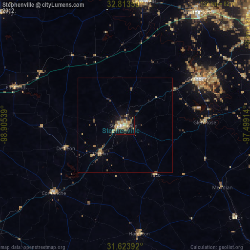
» Earth at Night: Flat Maps 2012, 2016