Bay Wood night lights from space
Night Light of Bay Wood (New York) from space (United States) Src. Average luminocity for 10x10km area is 90.3912% and for 50x50km: 45.5741%.
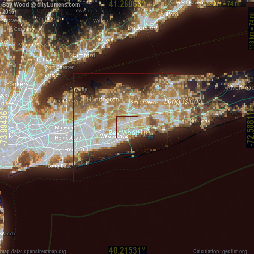
Analysis of Bay Wood night lights 2016
Square area 10x10 km:
 26.95%
90-99
33.77%80-89
21.92%70-79
12.66%60-69
2.44%50-59
1.14%40-49
0.65%30-39
0.49%20-29
0%10-19
0%0-9
0%Square area 50x50 km:
11.18%90-99
10.84%80-89
6.12%70-79
8.5%60-69
7.07%50-59
5.23%40-49
3.16%30-39
2.53%20-29
5.05%10-19
7.18%0-9
33.14%Clear (daylight) street map image can be seen on geolist.org.
Map coordinates:
41° 16' 50.3" North, 73° 59' 39.7" West
40° 45' 0.4" North, 73° 17' 28.4" West
40° 12' 55.1" North, 72° 35' 17.2" West
Some cities around Bay Wood sort by population:
• Brentwood
5.1 km =3.2 mi,  47°
47°
• West Babylon
6.4 km =4 mi,  236°
236°
• West Islip
5 km =3.1 mi,  194°
194°
• Deer Park
3.5 km =2.2 mi,  292°
292°
• Bay Shore
4.8 km =3 mi,  125°
125°
• North Bay Shore
2.9 km =1.8 mi,  122°
122°
• North Babylon
4.5 km =2.8 mi,  214°
214°
• Wyandanch
5.8 km =3.6 mi,  274°
274°
5108179 (p: 7,350)
Sources (retrieved 2019-11-25):
» Earth at Night: Flat Maps 2012, 2016