Wyandanch night lights from space
Night Light of Wyandanch (New York) from space (United States) Src. Average luminocity for 10x10km area is 88.7679% and for 50x50km: 48.1006%.
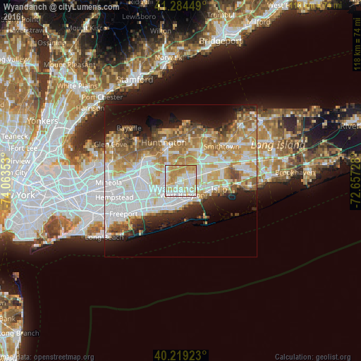
Analysis of Wyandanch night lights 2016
Square area 10x10 km:
 24.51%
90-99
29.55%80-89
18.34%70-79
22.4%60-69
5.19%50-59
0%40-49
0%30-39
0%20-29
0%10-19
0%0-9
0%Square area 50x50 km:
13.65%90-99
11.1%80-89
6.12%70-79
8.05%60-69
6.82%50-59
5.35%40-49
3.15%30-39
2.57%20-29
5.01%10-19
8.31%0-9
29.86%Clear (daylight) street map image can be seen on geolist.org.
Map coordinates:
41° 17' 4.2" North, 74° 3' 48.7" West
40° 45' 14.4" North, 73° 21' 37.4" West
40° 13' 9.2" North, 72° 39' 26.2" West
Some cities around Wyandanch sort by population:
• West Babylon
4 km =2.5 mi,  172°
172°
• Deer Park
2.8 km =1.7 mi,  71°
71°
• Dix Hills
6 km =3.7 mi,  19°
19°
• North Babylon
5.3 km =3.3 mi,  142°
142°
• North Lindenhurst
4.8 km =3 mi,  201°
201°
• Bay Wood
5.8 km =3.6 mi,  94°
94°
• East Farmingdale
5.5 km =3.4 mi,  239°
239°
• Wheatley Heights
1.3 km =0.8 mi,  323°
323°
5145135 (p: 11,647)
Sources (retrieved 2019-11-25):
» Earth at Night: Flat Maps 2012, 2016