North Bay Shore night lights from space
Night Light of North Bay Shore (New York) from space (United States) Src. Average luminocity for 10x10km area is 82.2484% and for 50x50km: 44.1485%.
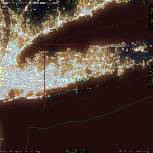
Analysis of North Bay Shore night lights 2016
Square area 10x10 km:
 22.56%
90-99
25.97%80-89
21.27%70-79
12.34%60-69
2.44%50-59
3.41%40-49
2.92%30-39
2.6%20-29
6.17%10-19
0.32%0-9
0%Square area 50x50 km:
10.26%90-99
10.47%80-89
6.06%70-79
8.33%60-69
7.42%50-59
5.51%40-49
2.89%30-39
2.35%20-29
4.79%10-19
6.75%0-9
35.17%Clear (daylight) street map image can be seen on geolist.org.
Map coordinates:
41° 16' 0.7" North, 73° 57' 56.7" West
40° 44' 10.4" North, 73° 15' 45.4" West
40° 12' 4.7" North, 72° 33' 34.2" West
Some cities around North Bay Shore sort by population:
• Brentwood
5.2 km =3.2 mi,  15°
15°
• West Islip
5 km =3.1 mi,  227°
227°
• Deer Park
6.3 km =3.9 mi,  296°
296°
• Bay Shore
1.9 km =1.2 mi,  130°
130°
• Islip
4.5 km =2.8 mi,  99°
99°
• East Islip
6.5 km =4 mi,  94°
94°
• Bay Wood
2.9 km =1.8 mi, 302°
• Islip Terrace
5.9 km =3.7 mi,  82°
82°
5128898 (p: 18,944)
Sources (retrieved 2019-11-25):
» Earth at Night: Flat Maps 2012, 2016