Millis night lights from space
Night Light of Millis (Massachusetts) from space (United States) Src. Average luminocity for 10x10km area is 24.2894% and for 50x50km: 48.1236%.
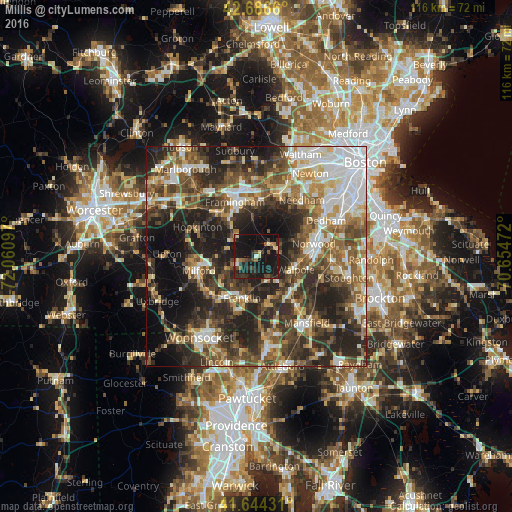
Analysis of Millis night lights 2016
Square area 10x10 km:
 0.45%
0.45%90-99
2.42%80-89
2.12%70-79
1.82%60-69
2.58%50-59
2.42%40-49
5.76%30-39
5.61%20-29
12.58%10-19
52.42%0-9
11.82%Square area 50x50 km:
8.72%90-99
7.84%80-89
5.52%70-79
5.05%60-69
6.47%50-59
8.85%40-49
9.88%30-39
9.94%20-29
16.66%10-19
15.09%0-9
5.97%Clear (daylight) street map image can be seen on geolist.org.
Map coordinates:
42° 41' 11.8" North, 72° 3' 39.5" West
42° 10' 3.4" North, 71° 21' 28.2" West
41° 38' 39.5" North, 70° 39' 17" West
Some cities around Millis sort by population:
• Franklin
9.9 km =6.2 mi,  198°
198°
• Westwood
12.1 km =7.5 mi,  64°
64°
• Holliston
6.6 km =4.1 mi,  303°
303°
• Medway
4.3 km =2.7 mi,  228°
228°
• Wrentham
11.5 km =7.1 mi,  167°
167°
• Norfolk
6 km =3.7 mi,  153°
153°
• Medfield
4.8 km =3 mi, 62°
• Walpole
9.4 km =5.8 mi,  107°
107°
4944173 (p: 8,040)
Sources (retrieved 2019-11-25):
» Earth at Night: Flat Maps 2012, 2016