Cochituate night lights from space
Night Light of Cochituate (Massachusetts) from space (United States) Src. Average luminocity for 10x10km area is 58.9848% and for 50x50km: 48.3474%.
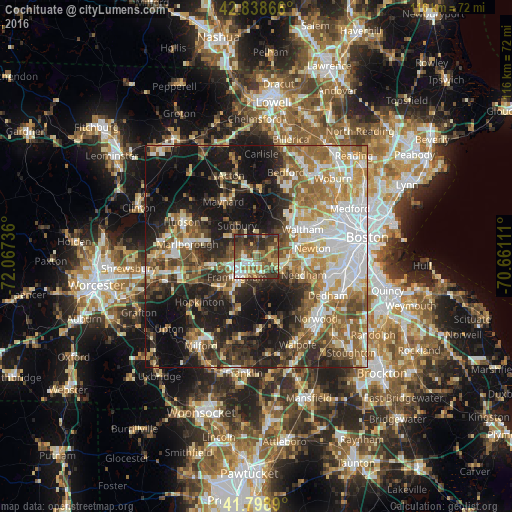
Analysis of Cochituate night lights 2016
Square area 10x10 km:
 8.33%
8.33%90-99
8.48%80-89
9.55%70-79
7.12%60-69
7.12%50-59
15.45%40-49
18.64%30-39
15.15%20-29
9.7%10-19
0.45%0-9
0%Square area 50x50 km:
9.69%90-99
8.85%80-89
5.8%70-79
5.9%60-69
7.41%50-59
8.05%40-49
7.34%30-39
6.29%20-29
11.46%10-19
20.55%0-9
8.65%Clear (daylight) street map image can be seen on geolist.org.
Map coordinates:
42° 50' 19.2" North, 72° 4' 2.5" West
42° 19' 15.3" North, 71° 21' 51.2" West
41° 47' 56" North, 70° 39' 40" West
Some cities around Cochituate sort by population:
• Framingham
6.3 km =3.9 mi,  222°
222°
• Framingham Center
6.5 km =4 mi,  246°
246°
• Natick
4.3 km =2.7 mi,  163°
163°
• Wellesley
6.5 km =4 mi,  114°
114°
• Sudbury
8.2 km =5.1 mi,  328°
328°
• Ashland
10.5 km =6.5 mi,  230°
230°
• Wayland
4.6 km =2.9 mi,  2°
2°
• Weston
7.2 km =4.5 mi,  44°
44°
4933493 (p: 6,569)
Sources (retrieved 2019-11-25):
» Earth at Night: Flat Maps 2012, 2016