Natick night lights from space
Night Light of Natick (Massachusetts) from space (United States) Src. Average luminocity for 10x10km area is 51.4% and for 50x50km: 49.2086%.
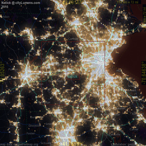
Analysis of Natick night lights 2016
Square area 10x10 km:
 7.42%
7.42%90-99
8.33%80-89
8.48%70-79
5.61%60-69
5.61%50-59
13.33%40-49
10.3%30-39
8.48%20-29
15.91%10-19
16.36%0-9
0.15%Square area 50x50 km:
10.06%90-99
9.18%80-89
6.14%70-79
5.95%60-69
6.89%50-59
7.78%40-49
7.54%30-39
7.16%20-29
12.43%10-19
18.24%0-9
8.64%Clear (daylight) street map image can be seen on geolist.org.
Map coordinates:
42° 48' 5.3" North, 72° 3' 9.5" West
42° 17' 0.3" North, 71° 20' 58.2" West
41° 45' 39.9" North, 70° 38' 47" West
Some cities around Natick sort by population:
• Framingham
5.5 km =3.4 mi,  265°
265°
• Framingham Center
7.4 km =4.6 mi,  282°
282°
• Needham
9.6 km =6 mi,  90°
90°
• Wellesley
4.9 km =3 mi,  72°
72°
• Ashland
9.7 km =6 mi,  255°
255°
• Wayland
8.9 km =5.5 mi,  353°
353°
• Weston
10 km =6.2 mi,  22°
22°
• Cochituate
4.3 km =2.7 mi,  343°
343°
4944994 (p: 32,276)
Sources (retrieved 2019-11-25):
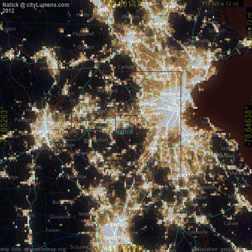
» Earth at Night: Flat Maps 2012, 2016