Uzhgorod night lights from space
Night Light of Uzhgorod (Transcarpathia) from space (Ukraine) Src. Average luminocity for 10x10km area is 30.2664% and for 50x50km: 2.1368%.
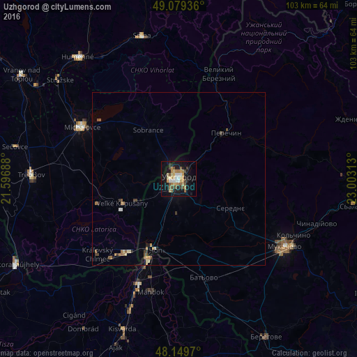

Analysis of Uzhgorod night lights 2016
Square area 10x10 km:
 2.98%
2.98%90-99
3.27%80-89
6.55%70-79
5.21%60-69
4.76%50-59
4.02%40-49
4.61%30-39
2.08%20-29
2.83%10-19
31.99%0-9
31.7%Square area 50x50 km:
0.15%90-99
0.18%80-89
0.38%70-79
0.3%60-69
0.36%50-59
0.37%40-49
0.34%30-39
0.25%20-29
0.19%10-19
1.54%0-9
95.95%Clear (daylight) street map image can be seen on geolist.org.
Map coordinates:
49° 4' 45.7" North, 21° 35' 48.8" East
48° 37' 0" North, 22° 18' 0" East
48° 8' 58.9" North, 23° 0' 11.3" East
Some cities around Uzhgorod sort by population:
• Mukacheve
36.5 km =22.7 mi,  122°
122°
• Michalovce, SK
31.9 km =19.8 mi,  298°
298°
• Chop
21.7 km =13.5 mi,  198°
198°
• Chlmec, SK
40 km =24.9 mi,  318°
318°
• Velykyi Bereznyi
32.4 km =20.1 mi,  21°
21°
• Perechyn
18.8 km =11.7 mi,  45°
45°
• Chynadiyovo
41.2 km =25.6 mi,  111°
111°
• Sobrance, SK
16.7 km =10.4 mi,  328°
328°
690548 (p: 117,878)
Sources (retrieved 2019-11-25):
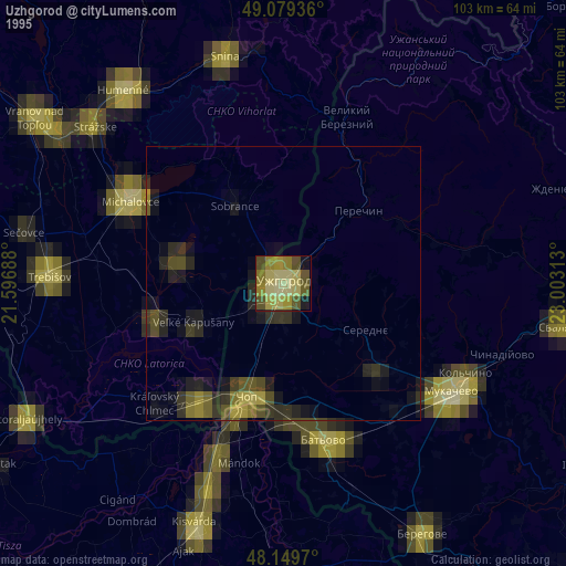
» NASA, Earths city lights 1995
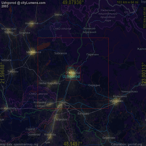
» NASA city lights 2003
» Earth at Night: Flat Maps 2012, 2016