Mukacheve night lights from space
Night Light of Mukacheve (Transcarpathia) from space (Ukraine) Src. Average luminocity for 10x10km area is 16.0369% and for 50x50km: 0.7394%.
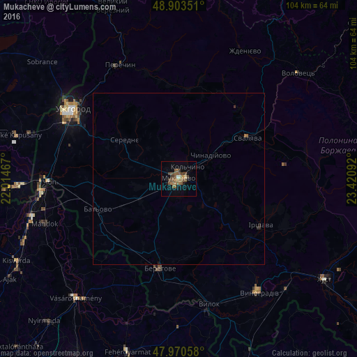
Analysis of Mukacheve night lights 2016
Square area 10x10 km:
 0.14%
0.14%90-99
0.99%80-89
0.57%70-79
0.57%60-69
5.68%50-59
7.67%40-49
4.26%30-39
2.27%20-29
0.28%10-19
3.84%0-9
73.72%Square area 50x50 km:
0.01%90-99
0.04%80-89
0.02%70-79
0.02%60-69
0.25%50-59
0.33%40-49
0.17%30-39
0.13%20-29
0.06%10-19
0.2%0-9
98.76%Clear (daylight) street map image can be seen on geolist.org.
Map coordinates:
48° 54' 12.6" North, 22° 0' 52.8" East
48° 26' 21.1" North, 22° 43' 4" East
47° 58' 14.1" North, 23° 25' 15.3" East
Some cities around Mukacheve sort by population:
• Uzhgorod
36.5 km =22.7 mi,  302°
302°
• Berehove
26.5 km =16.5 mi,  191°
191°
• Svalyava
23.8 km =14.8 mi,  59°
59°
• Irshava
27.3 km =17 mi,  119°
119°
• Chop
37.8 km =23.5 mi,  268°
268°
• Bilky
33.6 km =20.9 mi,  114°
114°
• Perechyn
37.3 km =23.2 mi,  332°
332°
• Chynadiyovo
9 km =5.6 mi, 58°
700646 (p: 81,633)
Sources (retrieved 2019-11-25):
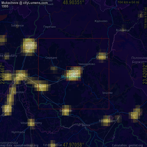
» NASA, Earths city lights 1995
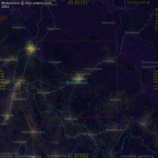
» NASA city lights 2003
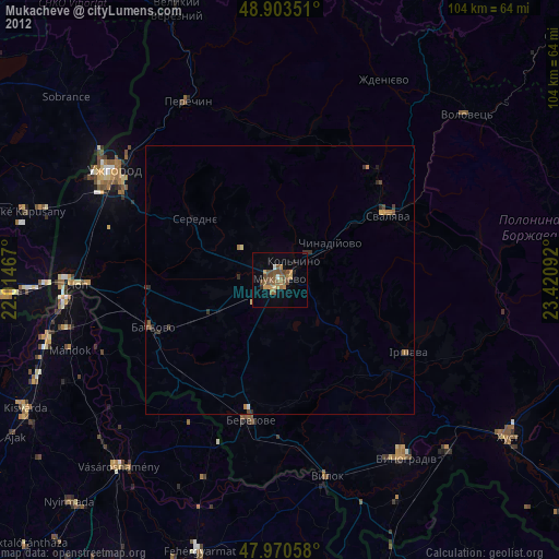
» Earth at Night: Flat Maps 2012, 2016