Sobrance night lights from space
Night Light of Sobrance (Košický kraj) from space (Slovakia) Src. Average luminocity for 10x10km area is 0% and for 50x50km: 2.1828%.
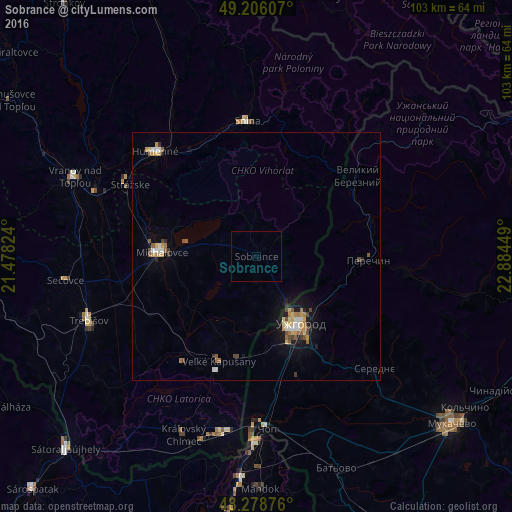
Analysis of Sobrance night lights 2016
Square area 10x10 km:
 0%
0%90-99
0%80-89
0%70-79
0%60-69
0%50-59
0%40-49
0%30-39
0%20-29
0%10-19
0%0-9
100%Square area 50x50 km:
0.2%90-99
0.26%80-89
0.33%70-79
0.37%60-69
0.26%50-59
0.37%40-49
0.3%30-39
0.21%20-29
0.18%10-19
1.4%0-9
96.12%Clear (daylight) street map image can be seen on geolist.org.
Map coordinates:
49° 12' 21.9" North, 21° 28' 41.7" East
48° 44' 40.4" North, 22° 10' 52.9" East
48° 16' 43.5" North, 22° 53' 4.2" East
Some cities around Sobrance sort by population:
• Uzhgorod, UA
16.7 km =10.4 mi,  148°
148°
• Michalovce
19.2 km =11.9 mi,  273°
273°
• Humenné
28.9 km =18 mi,  317°
317°
• Snina
27.2 km =16.9 mi,  355°
355°
• Chop, UA
34.8 km =21.6 mi,  177°
177°
• Chlmec
23.7 km =14.7 mi,  311°
311°
• Velykyi Bereznyi, UA
25.9 km =16.1 mi,  51°
51°
• Perechyn, UA
22.1 km =13.7 mi,  92°
92°
723554 (p: 6,262)
Sources (retrieved 2019-11-25):
» Earth at Night: Flat Maps 2012, 2016