Ruska Poliana night lights from space
Night Light of Ruska Poliana (Cherkasy) from space (Ukraine) Src. Average luminocity for 10x10km area is 1.1123% and for 50x50km: 2.6339%.
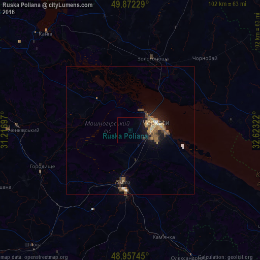
Analysis of Ruska Poliana night lights 2016
Square area 10x10 km:
 0%
0%90-99
0%80-89
0%70-79
0%60-69
0%50-59
0%40-49
0%30-39
0%20-29
0.27%10-19
2.14%0-9
97.59%Square area 50x50 km:
0.13%90-99
0.22%80-89
0.25%70-79
0.4%60-69
0.64%50-59
0.65%40-49
0.59%30-39
0.28%20-29
0.35%10-19
2.05%0-9
94.46%Clear (daylight) street map image can be seen on geolist.org.
Map coordinates:
49° 52' 20.2" North, 31° 13' 1.1" East
49° 25' 1.2" North, 31° 55' 12.3" East
48° 57' 26.8" North, 32° 37' 23.6" East
Some cities around Ruska Poliana sort by population:
• Cherkasy
10.3 km =6.4 mi,  82°
82°
• Smila
21.8 km =13.5 mi,  186°
186°
• Zolotonosha
29.3 km =18.2 mi,  17°
17°
• Korsun-Shevchenkivskyi
47.8 km =29.7 mi,  270°
270°
• Horodyshche
37.4 km =23.2 mi,  246°
246°
• Kamianka
44.9 km =27.9 mi,  162°
162°
• Chervona Sloboda
17.9 km =11.1 mi,  105°
105°
• Chornobay
40.5 km =25.2 mi,  46°
46°
695104 (p: 7,780)
Sources (retrieved 2019-11-25):
» Earth at Night: Flat Maps 2012, 2016