Cherkasy night lights from space
Night Light of Cherkasy from space (Ukraine) Src. Average luminocity for 10x10km area is 40.2834% and for 50x50km: 2.5526%.
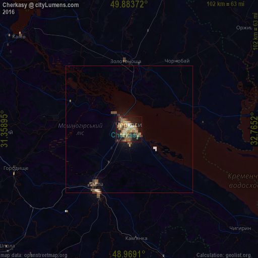
Analysis of Cherkasy night lights 2016
Square area 10x10 km:
 1.87%
1.87%90-99
3.21%80-89
5.21%70-79
8.82%60-69
13.24%50-59
8.29%40-49
8.16%30-39
2.94%20-29
7.49%10-19
28.88%0-9
11.9%Square area 50x50 km:
0.13%90-99
0.21%80-89
0.25%70-79
0.39%60-69
0.62%50-59
0.58%40-49
0.58%30-39
0.28%20-29
0.35%10-19
2.04%0-9
94.57%Clear (daylight) street map image can be seen on geolist.org.
Map coordinates:
49° 53' 1.4" North, 31° 21' 32.2" East
49° 25' 42.7" North, 32° 3' 43.5" East
48° 58' 8.8" North, 32° 45' 54.7" East
Some cities around Cherkasy sort by population:
• Smila
26.2 km =16.3 mi,  208°
208°
• Zolotonosha
26.7 km =16.6 mi,  356°
356°
• Horodyshche
47.4 km =29.5 mi,  250°
250°
• Kamianka
44.2 km =27.5 mi,  176°
176°
• Oleksandrivka
53.2 km =33.1 mi,  166°
166°
• Chervona Sloboda
9.3 km =5.8 mi,  131°
131°
• Chornobay
32.7 km =20.3 mi,  36°
36°
• Ruska Poliana
10.3 km =6.4 mi,  262°
262°
710791 (p: 297,568)
Sources (retrieved 2019-11-25):
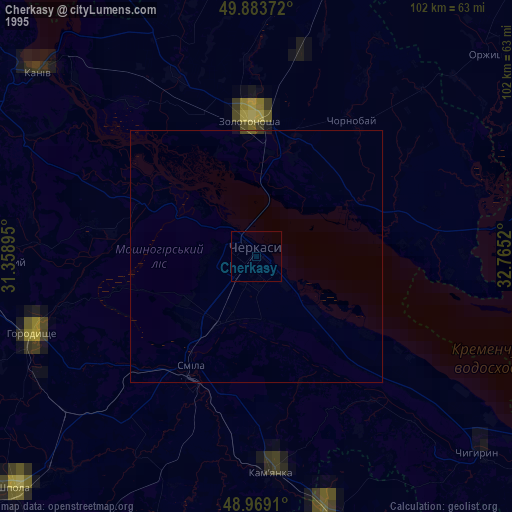
» NASA, Earths city lights 1995
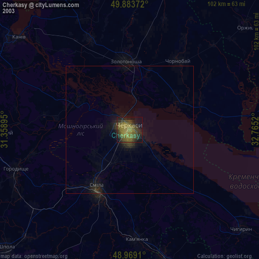
» NASA city lights 2003
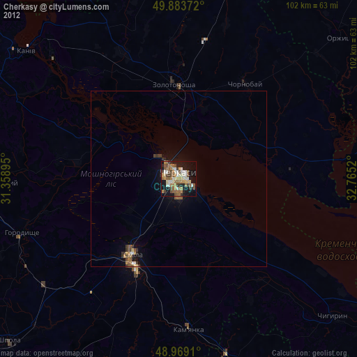
» Earth at Night: Flat Maps 2012, 2016