Kamianka night lights from space
Night Light of Kamianka (Cherkasy) from space (Ukraine) Src. Average luminocity for 10x10km area is 0.1756% and for 50x50km: 0.5268%.
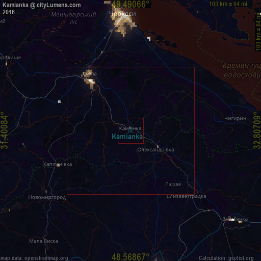
Analysis of Kamianka night lights 2016
Square area 10x10 km:
 0%
0%90-99
0%80-89
0%70-79
0%60-69
0%50-59
0%40-49
0%30-39
0%20-29
0.6%10-19
0%0-9
99.4%Square area 50x50 km:
0.02%90-99
0.05%80-89
0.02%70-79
0.02%60-69
0.05%50-59
0.23%40-49
0.24%30-39
0.13%20-29
0.03%10-19
0.15%0-9
99.07%Clear (daylight) street map image can be seen on geolist.org.
Map coordinates:
49° 29' 26.4" North, 31° 24' 3" East
49° 1' 54.5" North, 32° 6' 14.3" East
48° 34' 7.2" North, 32° 48' 25.5" East
Some cities around Kamianka sort by population:
• Cherkasy
44.2 km =27.5 mi,  356°
356°
• Smila
26.4 km =16.4 mi,  323°
323°
• Shpola
51.8 km =32.2 mi,  266°
266°
• Novomyrhorod
43.8 km =27.2 mi,  230°
230°
• Chyhyryn
40.6 km =25.2 mi,  81°
81°
• Oleksandrivka
12.2 km =7.6 mi,  128°
128°
• Chervona Sloboda
38.1 km =23.7 mi,  5°
5°
• Ruska Poliana
44.9 km =27.9 mi,  342°
342°
707052 (p: 14,547)
Sources (retrieved 2019-11-25):
» Earth at Night: Flat Maps 2012, 2016