Oleksandrivka night lights from space
Night Light of Oleksandrivka (Kirovohrad) from space (Ukraine) Src. Average luminocity for 10x10km area is 0.2397% and for 50x50km: 0.0423%.
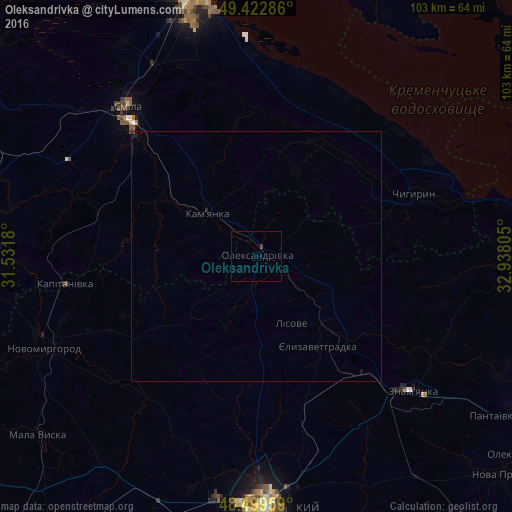
Analysis of Oleksandrivka night lights 2016
Square area 10x10 km:
 0%
0%90-99
0%80-89
0%70-79
0%60-69
0%50-59
0%40-49
0.55%30-39
0%20-29
0%10-19
0%0-9
99.45%Square area 50x50 km:
0%90-99
0%80-89
0%70-79
0%60-69
0%50-59
0%40-49
0.04%30-39
0%20-29
0.03%10-19
0.06%0-9
99.87%Clear (daylight) street map image can be seen on geolist.org.
Map coordinates:
49° 25' 22.3" North, 31° 31' 54.5" East
48° 57' 48.1" North, 32° 14' 5.7" East
48° 29' 58.5" North, 32° 56' 17" East
Some cities around Oleksandrivka sort by population:
• Cherkasy
53.2 km =33.1 mi,  346°
346°
• Kropyvnytskyi
50.1 km =31.1 mi,  177°
177°
• Smila
38.4 km =23.9 mi,  318°
318°
• Znomenka
42 km =26.1 mi,  131°
131°
• Kamianka
12.2 km =7.6 mi,  308°
308°
• Novomyrhorod
47.9 km =29.8 mi,  244°
244°
• Chyhyryn
33.5 km =20.8 mi,  66°
66°
• Chervona Sloboda
45.9 km =28.5 mi, 352°
698627 (p: 10,687)
Sources (retrieved 2019-11-25):
» Earth at Night: Flat Maps 2012, 2016