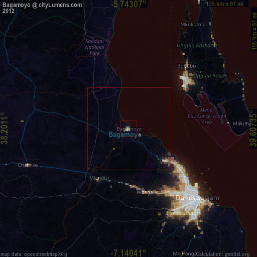
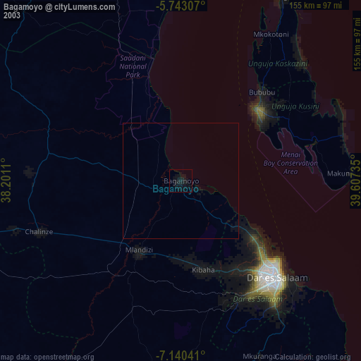
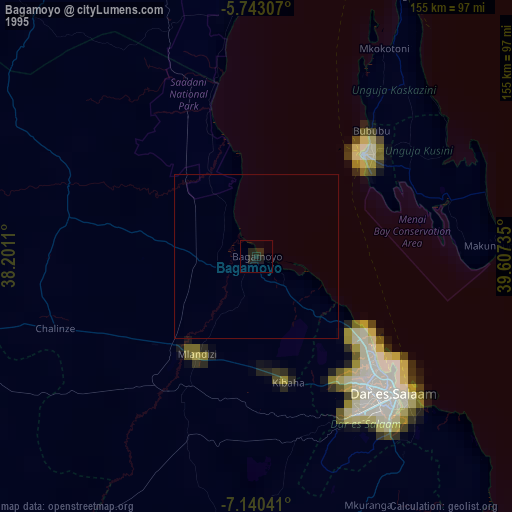
Bagamoyo night lights from space
Night Light of Bagamoyo (Pwani) from space (Tanzania) Src. Average luminocity for 10x10km area is 8% and for 50x50km: 1.7267%.
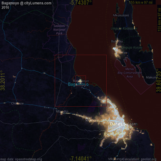
Analysis of Bagamoyo night lights 2016
Square area 10x10 km:
 0%
0%90-99
0%80-89
0%70-79
3.25%60-69
1.73%50-59
1.08%40-49
4.55%30-39
2.38%20-29
0%10-19
0%0-9
87.01%Square area 50x50 km:
0.04%90-99
0.15%80-89
0.02%70-79
0.38%60-69
0.43%50-59
0.21%40-49
0.61%30-39
0.39%20-29
0.67%10-19
0.89%0-9
96.21%Clear (daylight) street map image can be seen on geolist.org.
Map coordinates:
5° 44' 35.1" South, 38° 12' 4" East
6° 26' 32" South, 38° 54' 15.2" East
7° 8' 25.5" South, 39° 36' 26.5" East
Some cities around Bagamoyo sort by population:
• Dar es Salaam
58.5 km =36.4 mi,  136°
136°
• Zanzibar
44.8 km =27.8 mi,  46°
46°
• Mvomero
33.9 km =21.1 mi,  309°
309°
• Mlandizi
34.3 km =21.3 mi,  213°
213°
• Kibaha
36.1 km =22.4 mi,  177°
177°
• Magomeni
55.1 km =34.2 mi, 136°
• Kisarawe
54 km =33.6 mi,  160°
160°
• Koani
54.2 km =33.7 mi, 50°
161290 (p: 82,426)
Sources (retrieved 2019-11-25):
» NASA, Earths city lights 1995
» NASA city lights 2003
» Earth at Night: Flat Maps 2012, 2016